Machagai geodata
Machagai (Chaco) is a seat of a second-order administrative division; located in Argentina in America/Argentina/Cordoba (GMT-3) time zone. With population of 28,070 people, there are 144 cities with bigger population in this country. Compared to other cities in Argentina, 87.3% of cities are located further ↓South; 67.5% of cities are located further ←West and 66.6% of cities have higher elevation than Machagai. Note1


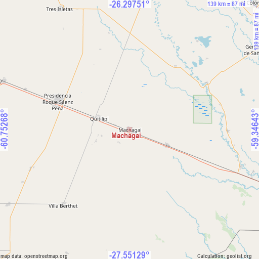
Machagai GPS coordinates[2]
26° 55' 34.104" South, 60° 2' 58.38" West
| Map corner | latitude | longitude |
|---|---|---|
| Upper-left | -26.29751°, | -60.75268° |
| Center: | -26.92614°, | -60.04955° |
| Lower-right: | -27.55129°, | -59.34643° |
| Map W x H: | 139.4×139.4 km | = 86.6×86.6mi |
| max Lat: | -21.94467° ⇑12.7% North |
| Machagai: | -26.92614° |
| min Lat: | ⇓87.3% South -54.81084° |
| min Long | Machagai | max Long |
| -72.88605° | -60.04955° | -53.64581° |
| W 67.5%⇐ | ⇒32.5% E |
Elevation
Elevation of Machagai is 90 m = 295 ft, and this is 259.3 m = 851 ft below average elevation for this country.
| Max E: |
4040 m = 13255 ft | 66.6% |
| Avg. | 349.3 m = 1146 ft | |
| Machagai | 90 m = 295 ft | |
Min E: |
-2 m = -7 ft | 33.4% |
See also: Argentina elevation on elevation.city.
Geographical zone
Machagai is located in South temperate zone (between Tropic of Capricorn and the Antarctic Circle). Distance of this Southern Tropic circle is 388 km =241.1 mi to North.| Distance of | km | miles | from Machagai |
|---|---|---|---|
| Equator | 2993.9 | 1860.3 | to North |
| Tropic Capricorn | 388 | 241.1 | to North |
| Antarctic Circle | 4407.3 | 2738.6 | to South |
| South Pole | 7013.2 | 4357.8 | to South |


Nearby cities:
15 places around Machagai: (largest is in red/bold)
• Capitán Solari
50.4 km =31.3 mi,  74°
74°
• Ciervo Petiso
56.6 km =35.2 mi,  47°
47°
• Colonia Elisa
52.6 km =32.7 mi,  90°
90°
• Colonias Unidas
48.6 km =30.2 mi,  58°
58°
• La Clotilde
65.3 km =40.6 mi,  249°
249°
• La Escondida
62.9 km =39.1 mi,  108°
108°
• La Tigra
57 km =35.4 mi, 249°
• La Verde
70.6 km =43.9 mi, 108°
• Laguna Limpia
60.3 km =37.5 mi,  37°
37°
• Las Garcitas
42.2 km =26.2 mi, 35°
• Napenay
60.2 km =37.4 mi,  290°
290°
• Presidencia Roque Sáenz Peña
41.7 km =25.9 mi, 292°
• Presidencia de la Plaza
22.2 km =13.8 mi, 112°
• Quitilipi
17.8 km =11.1 mi, 290°
• Villa Berthet
54.3 km =33.7 mi,  221°
221°
Sources, notices
• [Note1] Compared only with cities in Argentina existing in our database
• [Src1] Map data: © OpenStreetMap contributors (CC-BY-SA)
• [Src2] Other city data from geonames.org with taken over terms of usage.
• [Src3] Geographical zone / Annual Mean Temperature by Robert A. Rohde @ Wikipedia
