General Baldissera geodata
General Baldissera (Cordoba) is a populated place; located in Argentina in America/Argentina/Cordoba (GMT-3) time zone. With population of 2,133 people, there are 629 cities with bigger population in this country. Compared to other cities in Argentina, 63.2% of cities are located further ↑North; 53.4% of cities are located further ←West and 58.7% of cities have higher elevation than General Baldissera. Note1


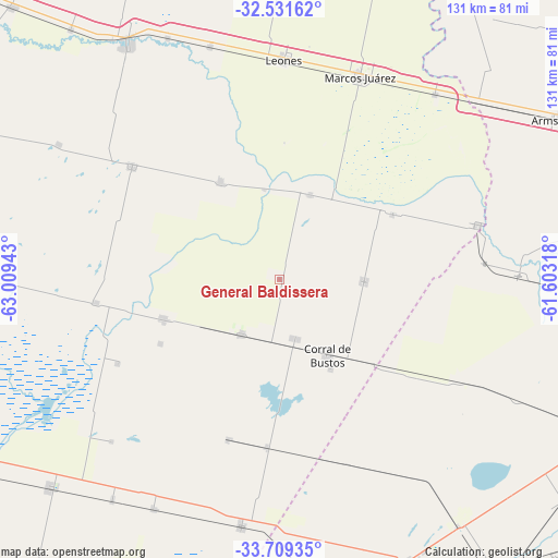
General Baldissera GPS coordinates[2]
33° 7' 20.856" South, 62° 18' 22.68" West
| Map corner | latitude | longitude |
|---|---|---|
| Upper-left | -32.53162°, | -63.00943° |
| Center: | -33.12246°, | -62.3063° |
| Lower-right: | -33.70935°, | -61.60318° |
| Map W x H: | 131×131 km | = 81.4×81.4mi |
| max Lat: | -21.94467° ⇑63.2% North |
| General Baldissera: | -33.12246° |
| min Lat: | ⇓36.8% South -54.81084° |
| min Long | General Baldiss | max Long |
| -72.88605° | -62.3063° | -53.64581° |
| W 53.4%⇐ | ⇒46.6% E |
Elevation
Elevation of General Baldissera is 112 m = 367 ft, and this is 237.3 m = 779 ft below average elevation for this country.
| Max E: |
4040 m = 13255 ft | 58.7% |
| Avg. | 349.3 m = 1146 ft | |
| General Baldissera | 112 m = 367 ft | |
Min E: |
-2 m = -7 ft | 41.3% |
See also: Argentina elevation on elevation.city.
Geographical zone
General Baldissera is located in South temperate zone (between Tropic of Capricorn and the Antarctic Circle). Distance of this Southern Tropic circle is 1077 km =669.2 mi to North.| Distance of | km | miles | from General Baldissera |
|---|---|---|---|
| Equator | 3682.9 | 2288.4 | to North |
| Tropic Capricorn | 1077 | 669.2 | to North |
| Antarctic Circle | 3718.3 | 2310.4 | to South |
| South Pole | 6324.2 | 3929.7 | to South |


Nearby cities:
15 places around General Baldissera: (largest is in red/bold)
• Camilo Aldao
19.7 km =12.2 mi,  91°
91°
• Cavanagh
39.4 km =24.5 mi,  184°
184°
• Chañar Ladeado
33.6 km =20.9 mi,  132°
132°
• Corral de Bustos
21 km =13 mi,  147°
147°
• Cruz Alta
48.2 km =30 mi,  74°
74°
• Guatimozín
39.6 km =24.6 mi,  198°
198°
• Inriville
21 km =13 mi,  19°
19°
• Isla Verde
16 km =9.9 mi,  214°
214°
• Justiniano Posse
43.6 km =27.1 mi,  307°
307°
• Leones
51.2 km =31.8 mi,  0°
0°
• Los Surgentes
30.6 km =19 mi,  59°
59°
• Marcos Juárez
50.8 km =31.6 mi, 21°
• Monte Buey
26.9 km =16.7 mi,  328°
328°
• Monte Maíz
28.9 km =18 mi,  251°
251°
• Wenceslao Escalante
43.6 km =27.1 mi,  262°
262°
Sources, notices
• [Note1] Compared only with cities in Argentina existing in our database
• [Src1] Map data: © OpenStreetMap contributors (CC-BY-SA)
• [Src2] Other city data from geonames.org with taken over terms of usage.
• [Src3] Geographical zone / Annual Mean Temperature by Robert A. Rohde @ Wikipedia
