Monte Buey geodata
Monte Buey (Cordoba) is a populated place; located in Argentina in America/Argentina/Cordoba (GMT-3) time zone. With population of 5,497 people, there are 420 cities with bigger population in this country. Compared to other cities in Argentina, 61.1% of cities are located further ↑North; 52.2% of cities are located further ←West and 58.1% of cities have higher elevation than Monte Buey. Note1


Monte Buey GPS coordinates[2]
32° 54' 59.112" South, 62° 27' 24.084" West
| Map corner | latitude | longitude |
|---|---|---|
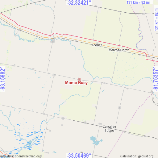
| Upper-left | -32.32421°, | -63.15982° |
| Center: | -32.91642°, | -62.45669° |
| Lower-right: | -33.50469°, | -61.75357° |
| Map W x H: | 131.3×131.3 km | = 81.6×81.6mi |
| max Lat: | -21.94467° ⇑61.1% North |
| Monte Buey: | -32.91642° |
| min Lat: | ⇓38.9% South -54.81084° |
| min Long | Monte Buey | max Long |
| -72.88605° | -62.45669° | -53.64581° |
| W 52.2%⇐ | ⇒47.8% E |
Elevation
Elevation of Monte Buey is 113 m = 371 ft, and this is 236.3 m = 775 ft below average elevation for this country.
| Max E: |
4040 m = 13255 ft | 58.1% |
| Avg. | 349.3 m = 1146 ft | |
| Monte Buey | 113 m = 371 ft | |
Min E: |
-2 m = -7 ft | 41.9% |
See also: Argentina elevation on elevation.city.
Geographical zone
Monte Buey is located in South temperate zone (between Tropic of Capricorn and the Antarctic Circle). Distance of this Southern Tropic circle is 1054 km =654.9 mi to North.| Distance of | km | miles | from Monte Buey |
|---|---|---|---|
| Equator | 3660 | 2274.2 | to North |
| Tropic Capricorn | 1054 | 654.9 | to North |
| Antarctic Circle | 3741.2 | 2324.7 | to South |
| South Pole | 6347.1 | 3943.9 | to South |


Nearby cities:
15 places around Monte Buey: (largest is in red/bold)
• Bell Ville
38.9 km =24.2 mi,  326°
326°
• Camilo Aldao
41.1 km =25.5 mi,  124°
124°
• Corral de Bustos
47.9 km =29.8 mi,  148°
148°
• General Baldissera
26.9 km =16.7 mi, 148°
• Inriville
21.4 km =13.3 mi,  98°
98°
• Isla Verde
36.4 km =22.6 mi,  172°
172°
• Justiniano Posse
21 km =13 mi,  279°
279°
• Laborde
45.6 km =28.3 mi,  234°
234°
• Leones
32 km =19.9 mi,  27°
27°
• Los Surgentes
41.3 km =25.7 mi, 100°
• Marcos Juárez
40.8 km =25.4 mi,  53°
53°
• Monte Maíz
34.7 km =21.6 mi,  202°
202°
• Morrison
50.3 km =31.3 mi,  315°
315°
• Ordóñez
39.1 km =24.3 mi, 282°
• Wenceslao Escalante
40.9 km =25.4 mi, 225°
Sources, notices
• [Note1] Compared only with cities in Argentina existing in our database
• [Src1] Map data: © OpenStreetMap contributors (CC-BY-SA)
• [Src2] Other city data from geonames.org with taken over terms of usage.
• [Src3] Geographical zone / Annual Mean Temperature by Robert A. Rohde @ Wikipedia
