Del Campillo geodata
Del Campillo (Cordoba) is a populated place; located in Argentina in America/Argentina/Cordoba (GMT-3) time zone. With population of 3,155 people, there are 543 cities with bigger population in this country. Compared to other cities in Argentina, 70.3% of cities are located further ↑North; 68.5% of cities are located further →East and 61.7% of cities have lower elevation than Del Campillo. Note1


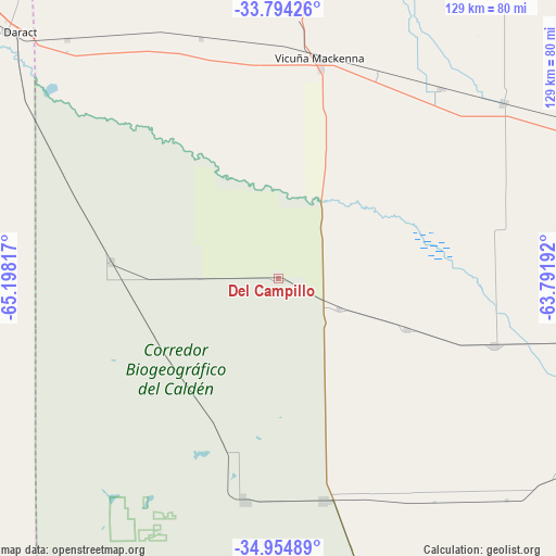
Del Campillo GPS coordinates[2]
34° 22' 35.724" South, 64° 29' 42.144" West
| Map corner | latitude | longitude |
|---|---|---|
| Upper-left | -33.79426°, | -65.19817° |
| Center: | -34.37659°, | -64.49504° |
| Lower-right: | -34.95489°, | -63.79192° |
| Map W x H: | 129×129.1 km | = 80.2×80.2mi |
| max Lat: | -21.94467° ⇑70.3% North |
| Del Campillo: | -34.37659° |
| min Lat: | ⇓29.7% South -54.81084° |
| min Long | Del Campillo | max Long |
| -72.88605° | -64.49504° | -53.64581° |
| W 31.5%⇐ | ⇒68.5% E |
Elevation
Elevation of Del Campillo is 228 m = 748 ft, and this is 121.3 m = 398 ft below average elevation for this country.
| Max E: |
4040 m = 13255 ft | 38.3% |
| Avg. | 349.3 m = 1146 ft | |
| Del Campillo | 228 m = 748 ft | |
Min E: |
-2 m = -7 ft | 61.7% |
See also: Argentina elevation on elevation.city.
Geographical zone
Del Campillo is located in South temperate zone (between Tropic of Capricorn and the Antarctic Circle). Distance of this Southern Tropic circle is 1216.4 km =755.8 mi to North.| Distance of | km | miles | from Del Campillo |
|---|---|---|---|
| Equator | 3822.3 | 2375.1 | to North |
| Tropic Capricorn | 1216.4 | 755.8 | to North |
| Antarctic Circle | 3578.9 | 2223.8 | to South |
| South Pole | 6184.7 | 3843 | to South |


Nearby cities:
15 places around Del Campillo: (largest is in red/bold)
• Buena Esperanza
81.3 km =50.5 mi,  238°
238°
• Coronel Moldes
84.4 km =52.4 mi,  353°
353°
• General Levalle
66.1 km =41.1 mi,  52°
52°
• Huinca Renancó
52.7 km =32.7 mi,  168°
168°
• Italó
80 km =49.7 mi,  125°
125°
• Justo Daract
85.5 km =53.1 mi,  312°
312°
• Mattaldi
31.8 km =19.8 mi,  111°
111°
• Parera
85.6 km =53.2 mi,  180°
180°
• Rancul
78.8 km =49 mi,  192°
192°
• Realicó
76.9 km =47.8 mi,  162°
162°
• Santa Magdalena
52.9 km =32.9 mi, 107°
• Serrano
88.3 km =54.9 mi,  96°
96°
• Vicuña Mackenna
51.7 km =32.1 mi,  10°
10°
• Villa Huidobro
52 km =32.3 mi, 189°
• Villa Valeria
39.2 km =24.4 mi,  275°
275°
Sources, notices
• [Note1] Compared only with cities in Argentina existing in our database
• [Src1] Map data: © OpenStreetMap contributors (CC-BY-SA)
• [Src2] Other city data from geonames.org with taken over terms of usage.
• [Src3] Geographical zone / Annual Mean Temperature by Robert A. Rohde @ Wikipedia
