Parera geodata
Parera (La Pampa) is a seat of a second-order administrative division; located in Argentina in America/Argentina/Salta (GMT-3) time zone. With population of 2,246 people, there are 613 cities with bigger population in this country. Compared to other cities in Argentina, 78.5% of cities are located further ↑North; 68.8% of cities are located further →East and 58.5% of cities have lower elevation than Parera. Note1


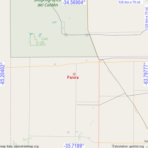
Parera GPS coordinates[2]
35° 8' 45.6" South, 64° 30' 3.204" West
| Map corner | latitude | longitude |
|---|---|---|
| Upper-left | -34.56904°, | -65.20402° |
| Center: | -35.146°, | -64.50089° |
| Lower-right: | -35.7189°, | -63.79777° |
| Map W x H: | 127.9×127.9 km | = 79.5×79.5mi |
| max Lat: | -21.94467° ⇑78.5% North |
| Parera: | -35.146° |
| min Lat: | ⇓21.5% South -54.81084° |
| min Long | Parera | max Long |
| -72.88605° | -64.50089° | -53.64581° |
| W 31.2%⇐ | ⇒68.8% E |
Elevation
Elevation of Parera is 202 m = 663 ft, and this is 147.3 m = 483 ft below average elevation for this country.
| Max E: |
4040 m = 13255 ft | 41.5% |
| Avg. | 349.3 m = 1146 ft | |
| Parera | 202 m = 663 ft | |
Min E: |
-2 m = -7 ft | 58.5% |
See also: Argentina elevation on elevation.city.
Geographical zone
Parera is located in South temperate zone (between Tropic of Capricorn and the Antarctic Circle). Distance of this Southern Tropic circle is 1301.9 km =809 mi to North.| Distance of | km | miles | from Parera |
|---|---|---|---|
| Equator | 3907.9 | 2428.3 | to North |
| Tropic Capricorn | 1301.9 | 809 | to North |
| Antarctic Circle | 3493.3 | 2170.6 | to South |
| South Pole | 6099.2 | 3789.9 | to South |


Nearby cities:
15 places around Parera: (largest is in red/bold)
• Alta Italia
40.8 km =25.4 mi,  120°
120°
• Arata
56.4 km =35 mi,  166°
166°
• Buena Esperanza
81.1 km =50.4 mi,  302°
302°
• Caleufú
50.3 km =31.3 mi,  185°
185°
• Embajador Martini
33.4 km =20.8 mi,  143°
143°
• Huinca Renancó
35.8 km =22.2 mi,  18°
18°
• Ingeniero Luiggi
26.9 km =16.7 mi, 173°
• Intendente Alvear
83.2 km =51.7 mi,  96°
96°
• Italó
76.4 km =47.5 mi,  59°
59°
• La Maruja
70.9 km =44.1 mi,  214°
214°
• Mattaldi
79.7 km =49.5 mi, 22°
• Rancul
18.5 km =11.5 mi, 297°
• Realicó
26.3 km =16.3 mi, 62°
• Trenel
69.9 km =43.4 mi,  151°
151°
• Villa Huidobro
35.1 km =21.8 mi,  347°
347°
Sources, notices
• [Note1] Compared only with cities in Argentina existing in our database
• [Src1] Map data: © OpenStreetMap contributors (CC-BY-SA)
• [Src2] Other city data from geonames.org with taken over terms of usage.
• [Src3] Geographical zone / Annual Mean Temperature by Robert A. Rohde @ Wikipedia
