Andalgalá geodata
Andalgalá (Catamarca) is a seat of a second-order administrative division; located in Argentina in America/Argentina/Catamarca (GMT-3) time zone. With population of 14,068 people, there are 237 cities with bigger population in this country. Compared to other cities in Argentina, 78.9% of cities are located further ↓South; 84.1% of cities are located further →East and 92.5% of cities have lower elevation than Andalgalá. Note1


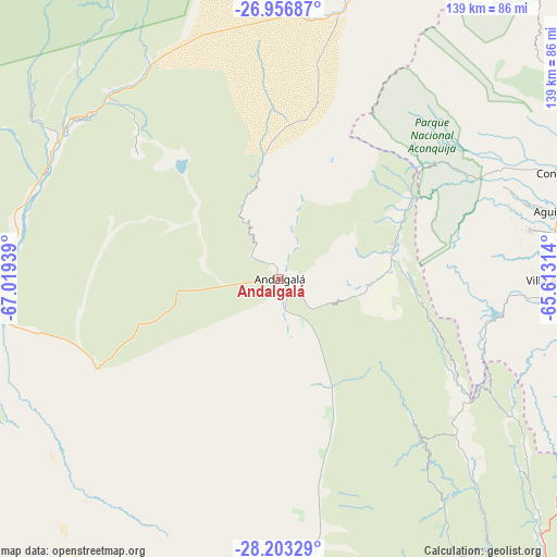
Andalgalá GPS coordinates[2]
27° 34' 54.66" South, 66° 18' 58.536" West
| Map corner | latitude | longitude |
|---|---|---|
| Upper-left | -26.95687°, | -67.01939° |
| Center: | -27.58185°, | -66.31626° |
| Lower-right: | -28.20329°, | -65.61314° |
| Map W x H: | 138.6×138.6 km | = 86.1×86.1mi |
| max Lat: | -21.94467° ⇑21.1% North |
| Andalgalá: | -27.58185° |
| min Lat: | ⇓78.9% South -54.81084° |
| min Long | Andalgalá | max Long |
| -72.88605° | -66.31626° | -53.64581° |
| W 15.9%⇐ | ⇒84.1% E |
Elevation
Elevation of Andalgalá is 1020 m = 3346 ft, and this is 670.7 m = 2200 ft above average elevation for this country.
| Max E: |
4040 m = 13255 ft | 7.5% |
| Andalgalá | 1020 m 3346 ft | |
| Avg. | 349.3 m = 1146 ft | |
Min E: |
-2 m = -7 ft | 92.5% |
See also: Argentina elevation on elevation.city.
Geographical zone
Andalgalá is located in South temperate zone (between Tropic of Capricorn and the Antarctic Circle). Distance of this Southern Tropic circle is 460.9 km =286.4 mi to North.| Distance of | km | miles | from Andalgalá |
|---|---|---|---|
| Equator | 3066.8 | 1905.6 | to North |
| Tropic Capricorn | 460.9 | 286.4 | to North |
| Antarctic Circle | 4334.4 | 2693.3 | to South |
| South Pole | 6940.2 | 4312.4 | to South |


Nearby cities:
15 places around Andalgalá: (largest is in red/bold)
• Aguilares
71.2 km =44.2 mi,  76°
76°
• Belén
70.6 km =43.9 mi,  263°
263°
• Concepción
75.9 km =47.2 mi,  69°
69°
• El Rodeo
82.7 km =51.4 mi,  148°
148°
• Graneros
86.8 km =53.9 mi,  94°
94°
• Hualfín
64.2 km =39.9 mi,  307°
307°
• La Cocha
74.8 km =46.5 mi,  106°
106°
• La Puerta
83.4 km =51.8 mi,  141°
141°
• La Puerta de San José
69.1 km =42.9 mi,  272°
272°
• Londres
81.8 km =50.8 mi, 259°
• Los Varela
58.4 km =36.3 mi,  131°
131°
• Mutquín
83.9 km =52.1 mi,  168°
168°
• Puerta de Corral Quemado
72.6 km =45.1 mi,  302°
302°
• San Antonio
76.4 km =47.5 mi, 128°
• Saujil
66.7 km =41.4 mi, 171°
Sources, notices
• [Note1] Compared only with cities in Argentina existing in our database
• [Src1] Map data: © OpenStreetMap contributors (CC-BY-SA)
• [Src2] Other city data from geonames.org with taken over terms of usage.
• [Src3] Geographical zone / Annual Mean Temperature by Robert A. Rohde @ Wikipedia
