Belén geodata
Belén (Catamarca) is a seat of a second-order administrative division; located in Argentina in America/Argentina/Catamarca (GMT-3) time zone. In our database, there are 785 cities with bigger population. Compared to other cities in Argentina, 78.2% of cities are located further ↓South; 86.2% of cities are located further →East and 95.5% of cities have lower elevation than Belén. Note1


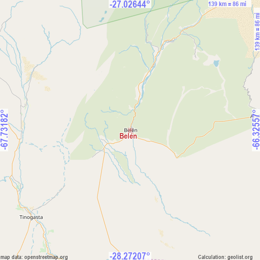
Belén GPS coordinates[2]
27° 39' 3.708" South, 67° 1' 43.284" West
| Map corner | latitude | longitude |
|---|---|---|
| Upper-left | -27.02644°, | -67.73182° |
| Center: | -27.65103°, | -67.02869° |
| Lower-right: | -28.27207°, | -66.32557° |
| Map W x H: | 138.5×138.5 km | = 86.1×86.1mi |
| max Lat: | -21.94467° ⇑21.8% North |
| Belén: | -27.65103° |
| min Lat: | ⇓78.2% South -54.81084° |
| min Long | Belén | max Long |
| -72.88605° | -67.02869° | -53.64581° |
| W 13.8%⇐ | ⇒86.2% E |
Elevation
Elevation of Belén is 1262 m = 4140 ft, and this is 912.7 m = 2994 ft above average elevation for this country.
| Max E: |
4040 m = 13255 ft | 4.5% |
| Belén | 1262 m 4140 ft | |
| Avg. | 349.3 m = 1146 ft | |
Min E: |
-2 m = -7 ft | 95.5% |
See also: Argentina elevation on elevation.city.
Geographical zone
Belén is located in South temperate zone (between Tropic of Capricorn and the Antarctic Circle). Distance of this Southern Tropic circle is 468.6 km =291.2 mi to North.| Distance of | km | miles | from Belén |
|---|---|---|---|
| Equator | 3074.5 | 1910.4 | to North |
| Tropic Capricorn | 468.6 | 291.2 | to North |
| Antarctic Circle | 4326.7 | 2688.5 | to South |
| South Pole | 6932.6 | 4307.7 | to South |


Nearby cities:
15 places around Belén: (largest is in red/bold)
• Aimogasta
103.5 km =64.3 mi,  167°
167°
• Andalgalá
70.6 km =43.9 mi,  83°
83°
• Arauco
105.9 km =65.8 mi, 167°
• El Rodeo
129.6 km =80.5 mi,  118°
118°
• Fiambalá
58.2 km =36.2 mi,  267°
267°
• Hualfín
50.8 km =31.6 mi,  22°
22°
• La Puerta de San José
11.3 km =7 mi,  6°
6°
• Londres
12.5 km =7.8 mi,  235°
235°
• Los Varela
118 km =73.3 mi,  105°
105°
• Mutquín
114.5 km =71.1 mi,  130°
130°
• Pomán
114.6 km =71.2 mi,  136°
136°
• Puerta de Corral Quemado
47.7 km =29.6 mi, 11°
• San Blas de los Sauces
84.7 km =52.6 mi,  184°
184°
• Saujil
99.1 km =61.6 mi, 125°
• Tinogasta
69.8 km =43.4 mi,  228°
228°
Sources, notices
• [Note1] Compared only with cities in Argentina existing in our database
• [Src1] Map data: © OpenStreetMap contributors (CC-BY-SA)
• [Src2] Other city data from geonames.org with taken over terms of usage.
• [Src3] Geographical zone / Annual Mean Temperature by Robert A. Rohde @ Wikipedia
