Adrogué geodata
Adrogué (Buenos Aires) is a populated place; located in Argentina in America/Argentina/Buenos_Aires (GMT-3) time zone. With population of 28,265 people, there are 142 cities with bigger population in this country. Compared to other cities in Argentina, 76% of cities are located further ↑North; 85.7% of cities are located further ←West and 90.3% of cities have higher elevation than Adrogué. Note1


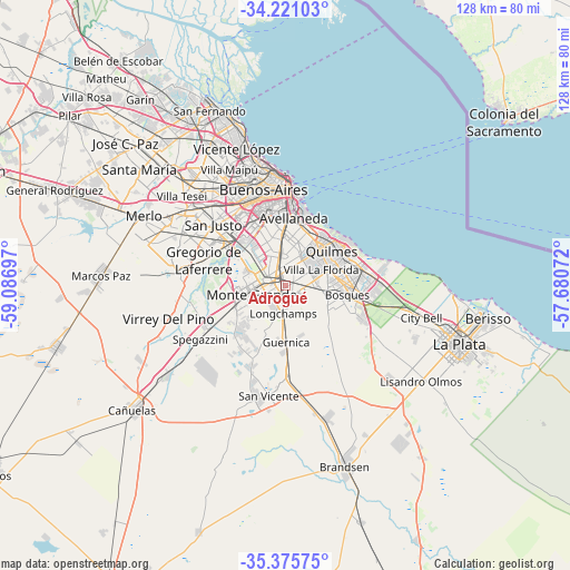
Adrogué GPS coordinates[2]
34° 48' 1.476" South, 58° 23' 1.824" West
| Map corner | latitude | longitude |
|---|---|---|
| Upper-left | -34.22103°, | -59.08697° |
| Center: | -34.80041°, | -58.38384° |
| Lower-right: | -35.37575°, | -57.68072° |
| Map W x H: | 128.4×128.4 km | = 79.8×79.8mi |
| max Lat: | -21.94467° ⇑76% North |
| Adrogué: | -34.80041° |
| min Lat: | ⇓24% South -54.81084° |
| min Long | Adrogué | max Long |
| -72.88605° | -58.38384° | -53.64581° |
| W 85.7%⇐ | ⇒14.3% E |
Elevation
Elevation of Adrogué is 28 m = 92 ft, and this is 321.3 m = 1054 ft below average elevation for this country.
| Max E: |
4040 m = 13255 ft | 90.3% |
| Avg. | 349.3 m = 1146 ft | |
| Adrogué | 28 m = 92 ft | |
Min E: |
-2 m = -7 ft | 9.7% |
See also: Argentina elevation on elevation.city.
Geographical zone
Adrogué is located in South temperate zone (between Tropic of Capricorn and the Antarctic Circle). Distance of this Southern Tropic circle is 1263.5 km =785.1 mi to North.| Distance of | km | miles | from Adrogué |
|---|---|---|---|
| Equator | 3869.4 | 2404.3 | to North |
| Tropic Capricorn | 1263.5 | 785.1 | to North |
| Antarctic Circle | 3531.7 | 2194.5 | to South |
| South Pole | 6137.6 | 3813.7 | to South |


Nearby cities:
15 places around Adrogué: (largest is in red/bold)
• Avellaneda
15.7 km =9.8 mi,  5°
5°
• Balvanera
21.2 km =13.2 mi,  356°
356°
• Barracas
16.8 km =10.4 mi,  0°
0°
• Berazategui
16.1 km =10 mi,  75°
75°
• Boedo
18.8 km =11.7 mi,  350°
350°
• Buenos Aires
20.8 km =12.9 mi, 1°
• Florencio Varela
3.2 km =2 mi,  199°
199°
• Guernica
12.9 km =8 mi,  178°
178°
• José María Ezeiza
14.2 km =8.8 mi,  248°
248°
• Lanús
10.9 km =6.8 mi, 354°
• Lomas de Zamora
4.9 km =3 mi,  334°
334°
• Quilmes
13.5 km =8.4 mi,  54°
54°
• San Justo
21.2 km =13.2 mi,  310°
310°
• Villa Lugano
15.7 km =9.8 mi, 328°
• Villa Santa Rita
22.9 km =14.2 mi,  337°
337°
Sources, notices
• [Note1] Compared only with cities in Argentina existing in our database
• [Src1] Map data: © OpenStreetMap contributors (CC-BY-SA)
• [Src2] Other city data from geonames.org with taken over terms of usage.
• [Src3] Geographical zone / Annual Mean Temperature by Robert A. Rohde @ Wikipedia
