Ta`ū geodata
Ta`ū (Manu'a) is a seat of a first-order administrative division; located in American Samoa in Pacific/Pago_Pago (GMT-11) time zone. With population of 873 people, there are 11 cities with bigger population in this country. Compared to other cities in American Samoa, 86.4% of cities are located further ↓South; 95.5% of cities are located further ←West and 90.9% of cities have higher elevation than Ta`ū. Note1


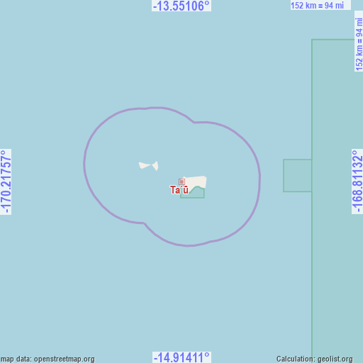
Ta`ū GPS coordinates[2]
14° 14' 0.996" South, 169° 30' 51.984" West
| Map corner | latitude | longitude |
|---|---|---|
| Upper-left | -13.55106°, | -170.21757° |
| Center: | -14.23361°, | -169.51444° |
| Lower-right: | -14.91411°, | -168.81132° |
| Map W x H: | 151.6×151.6 km | = 94.2×94.2mi |
| max Lat: | -11.05528° ⇑13.6% North |
| Ta`ū: | -14.23361° |
| min Lat: | ⇓86.4% South -14.36111° |
| min Long | Ta`ū | max Long |
| -171.08833° | -169.51444° | -169.51278° |
| W 95.5%⇐ | ⇒4.5% E |
Elevation
Elevation of Ta`ū is 12 m = 39 ft, and this is 48.3 m = 158 ft below average elevation for this country.
| Max E: |
363 m = 1191 ft | 90.9% |
| Avg. | 60.3 m = 198 ft | |
| Ta`ū | 12 m = 39 ft | |
Min E: |
5 m = 16 ft | 9.1% |
See also: American Samoa elevation on elevation.city.
Geographical zone
Ta`ū is located in South Torrid zone (between Equator and Tropic of Capricorn). Distance of this Southern Tropic circle is 1023.3 km =635.8 mi to South.| Distance of | km | miles | from Ta`ū |
|---|---|---|---|
| Equator | 1582.6 | 983.4 | to North |
| Tropic Capricorn | 1023.3 | 635.8 | to South |
| Antarctic Circle | 5818.5 | 3615.4 | to South |
| South Pole | 8424.4 | 5234.7 | to South |


Nearby cities:
15 places around Ta`ū: (largest is in red/bold)
• Alao
113.1 km =70.3 mi,  268°
268°
• Aūa
124 km =77.1 mi, 267°
• Fagatogo
126.8 km =78.8 mi, 267°
• Faleniu
133 km =82.6 mi, 265°
• Faleāsao
1.3 km =0.8 mi,  8°
8°
• Leloaloa
125.5 km =78 mi, 268°
• Malaeimi
131.8 km =81.9 mi, 265°
• Mapusagafou
133.9 km =83.2 mi, 265°
• Mesepa
133 km =82.6 mi, 265°
• Ofu
18.7 km =11.6 mi,  290°
290°
• Pago Pago
128.1 km =79.6 mi, 267°
• Tāfuna
130.4 km =81 mi,  264°
264°
• Utulei
126.1 km =78.4 mi, 267°
• Vaitogi
132.2 km =82.1 mi, 263°
• Āfono
122.5 km =76.1 mi, 268°
Sources, notices
• [Note1] Compared only with cities in American Samoa existing in our database
• [Src1] Map data: © OpenStreetMap contributors (CC-BY-SA)
• [Src2] Other city data from geonames.org with taken over terms of usage.
• [Src3] Geographical zone / Annual Mean Temperature by Robert A. Rohde @ Wikipedia
