Ofu geodata
Ofu (Manu'a) is a seat of a second-order administrative division; located in American Samoa in Pacific/Pago_Pago (GMT-11) time zone. With population of 254 people, there are 20 cities with bigger population in this country. Compared to other cities in American Samoa, 95.5% of cities are located further ↓South; 90.9% of cities are located further ←West and 72.7% of cities have higher elevation than Ofu. Note1


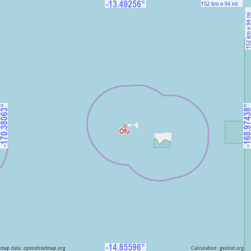
Ofu GPS coordinates[2]
14° 10' 31.008" South, 169° 40' 39" West
| Map corner | latitude | longitude |
|---|---|---|
| Upper-left | -13.49256°, | -170.38063° |
| Center: | -14.17528°, | -169.6775° |
| Lower-right: | -14.85596°, | -168.97438° |
| Map W x H: | 151.6×151.6 km | = 94.2×94.2mi |
| max Lat: | -11.05528° ⇑4.5% North |
| Ofu: | -14.17528° |
| min Lat: | ⇓95.5% South -14.36111° |
| min Long | Ofu | max Long |
| -171.08833° | -169.6775° | -169.51278° |
| W 90.9%⇐ | ⇒9.1% E |
Elevation
Elevation of Ofu is 17 m = 56 ft, and this is 43.3 m = 142 ft below average elevation for this country.
| Max E: |
363 m = 1191 ft | 72.7% |
| Avg. | 60.3 m = 198 ft | |
| Ofu | 17 m = 56 ft | |
Min E: |
5 m = 16 ft | 27.3% |
See also: American Samoa elevation on elevation.city.
Geographical zone
Ofu is located in South Torrid zone (between Equator and Tropic of Capricorn). Distance of this Southern Tropic circle is 1029.8 km =639.9 mi to South.| Distance of | km | miles | from Ofu |
|---|---|---|---|
| Equator | 1576.1 | 979.3 | to North |
| Tropic Capricorn | 1029.8 | 639.9 | to South |
| Antarctic Circle | 5825 | 3619.5 | to South |
| South Pole | 8430.9 | 5238.7 | to South |


Nearby cities:
15 places around Ofu: (largest is in red/bold)
• Alao
96.1 km =59.7 mi,  263°
263°
• Aūa
106.9 km =66.4 mi, 263°
• Fagatogo
109.8 km =68.2 mi, 263°
• Faleniu
116.3 km =72.3 mi, 261°
• Faleāsao
18.5 km =11.5 mi,  106°
106°
• Leloaloa
108.4 km =67.4 mi, 264°
• Malaeimi
115 km =71.5 mi, 261°
• Mapusagafou
117.2 km =72.8 mi, 261°
• Mesepa
116.3 km =72.3 mi, 261°
• Pago Pago
111.1 km =69 mi, 264°
• Ta`ū
18.7 km =11.6 mi, 110°
• Tāfuna
113.8 km =70.7 mi, 260°
• Utulei
109.1 km =67.8 mi, 263°
• Vaitogi
115.7 km =71.9 mi, 259°
• Āfono
105.4 km =65.5 mi, 264°
Sources, notices
• [Note1] Compared only with cities in American Samoa existing in our database
• [Src1] Map data: © OpenStreetMap contributors (CC-BY-SA)
• [Src2] Other city data from geonames.org with taken over terms of usage.
• [Src3] Geographical zone / Annual Mean Temperature by Robert A. Rohde @ Wikipedia
