Zeiselmauer geodata
Zeiselmauer (Lower Austria) is a populated place; located in Austria in Europe/Vienna (GMT+2) time zone. With population of 1,376 people, there are 916 cities with bigger population in this country. Compared to other cities in Austria, 87.2% of cities are located further ↓South; 85.4% of cities are located further ←West and 95.7% of cities have higher elevation than Zeiselmauer. Note1
Administrative division(s):
- Level 1: Lower Austria
- Level 2: Politischer Bezirk Tulln
- Level 3: Zeiselmauer-Wolfpassing


Zeiselmauer GPS coordinates[2]
48° 19' 42.672" North, 16° 10' 32.34" East
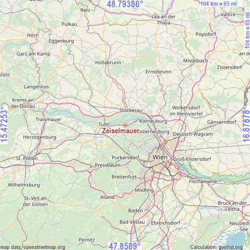
| Map corner | latitude | longitude |
|---|---|---|
| Upper-left | 48.79386°, | 15.47253° |
| Center: | 48.32852°, | 16.17565° |
| Lower-right: | 47.8589°, | 16.87878° |
| Map W x H: | 104×104 km | = 64.6×64.6mi |
| max Lat: | 48.98333° ⇑12.8% North |
| Zeiselmauer: | 48.32852° |
| min Lat: | ⇓87.2% South 46.48841° |
| min Long | Zeiselmauer | max Long |
| 9.57802° | 16.17565° | 17.1° |
| W 85.4%⇐ | ⇒14.6% E |
Elevation
Elevation of Zeiselmauer is 173 m = 568 ft, and this is 332.5 m = 1091 ft below average elevation for this country.
| Max E: |
2140 m = 7021 ft | 95.7% |
| Avg. | 505.5 m = 1658 ft | |
| Zeiselmauer | 173 m = 568 ft | |
Min E: |
118 m = 387 ft | 4.3% |
See also: Austria elevation on elevation.city.
Geographical zone
Zeiselmauer is located in North temperate zone (between Tropic of Cancer and the Arctic Circle). Distance of this North polar circle is 2027.5 km =1259.8 mi to North.| Distance of | km | miles | from Zeiselmauer |
|---|---|---|---|
| North Pole | 4633.4 | 2879.1 | to North |
| Arctic Circle | 2027.5 | 1259.8 | to North |
| Tropic Cancer | 2767.7 | 1719.8 | to South |
| Equator | 5373.6 | 3339 | to South |


Nearby cities:
15 places around Zeiselmauer: (largest is in red/bold)
• Altenberg
4.3 km =2.7 mi,  75°
75°
• Goldgeben
7.5 km =4.7 mi,  324°
324°
• Gugging
5.6 km =3.5 mi,  106°
106°
• Hintersdorf
4.4 km =2.7 mi,  136°
136°
• Katzelsdorf
7 km =4.3 mi,  225°
225°
• Kirchbach
5 km =3.1 mi,  161°
161°
• Königstetten
3.7 km =2.3 mi,  217°
217°
• Langenlebarn-Oberaigen
4.8 km =3 mi,  272°
272°
• Muckendorf an der Donau
1.5 km =0.9 mi,  283°
283°
• Sankt Andrä vor dem Hagenthale
2.4 km =1.5 mi, 107°
• Stockerau
6.8 km =4.2 mi,  26°
26°
• Tulbing
5.6 km =3.5 mi, 225°
• Unteraigen
3.4 km =2.1 mi, 275°
• Wolfpassing
1.7 km =1.1 mi,  172°
172°
• Wördern
2.6 km =1.6 mi, 76°
Sources, notices
• [Note1] Compared only with cities in Austria existing in our database
• [Src1] Map data: © OpenStreetMap contributors (CC-BY-SA)
• [Src2] Other city data from geonames.org with taken over terms of usage.
• [Src3] Geographical zone / Annual Mean Temperature by Robert A. Rohde @ Wikipedia
