Wolfpassing geodata
Wolfpassing (Lower Austria) is a populated place; located in Austria in Europe/Vienna (GMT+2) time zone. With population of 926 people, there are 1389 cities with bigger population in this country. Compared to other cities in Austria, 86.4% of cities are located further ↓South; 85.5% of cities are located further ←West and 95.5% of cities have higher elevation than Wolfpassing. Note1
Administrative division(s):
- Level 1: Lower Austria
- Level 2: Politischer Bezirk Tulln
- Level 3: Zeiselmauer-Wolfpassing


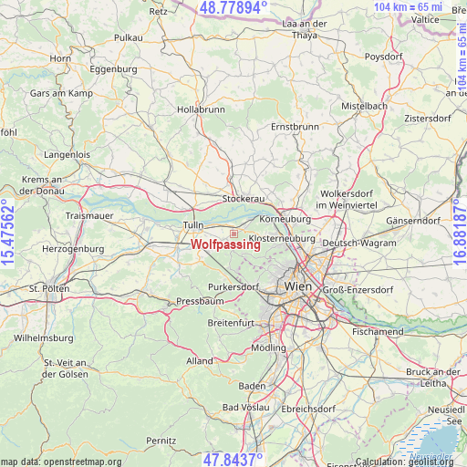
Wolfpassing GPS coordinates[2]
48° 18' 48.456" North, 16° 10' 43.464" East
| Map corner | latitude | longitude |
|---|---|---|
| Upper-left | 48.77894°, | 15.47562° |
| Center: | 48.31346°, | 16.17874° |
| Lower-right: | 47.8437°, | 16.88187° |
| Map W x H: | 104×104 km | = 64.6×64.6mi |
| max Lat: | 48.98333° ⇑13.6% North |
| Wolfpassing: | 48.31346° |
| min Lat: | ⇓86.4% South 46.48841° |
| min Long | Wolfpassing | max Long |
| 9.57802° | 16.17874° | 17.1° |
| W 85.5%⇐ | ⇒14.5% E |
Elevation
Elevation of Wolfpassing is 175 m = 574 ft, and this is 330.5 m = 1084 ft below average elevation for this country.
| Max E: |
2140 m = 7021 ft | 95.5% |
| Avg. | 505.5 m = 1658 ft | |
| Wolfpassing | 175 m = 574 ft | |
Min E: |
118 m = 387 ft | 4.5% |
See also: Austria elevation on elevation.city.
Geographical zone
Wolfpassing is located in North temperate zone (between Tropic of Cancer and the Arctic Circle). Distance of this North polar circle is 2029.2 km =1260.9 mi to North.| Distance of | km | miles | from Wolfpassing |
|---|---|---|---|
| North Pole | 4635.1 | 2880.1 | to North |
| Arctic Circle | 2029.2 | 1260.9 | to North |
| Tropic Cancer | 2766 | 1718.7 | to South |
| Equator | 5372 | 3338 | to South |


Nearby cities:
15 places around Wolfpassing: (largest is in red/bold)
• Altenberg
4.8 km =3 mi,  54°
54°
• Gugging
5.2 km =3.2 mi,  89°
89°
• Hintersdorf
3.2 km =2 mi,  118°
118°
• Katzelsdorf
6.1 km =3.8 mi,  238°
238°
• Kierling
7.2 km =4.5 mi, 93°
• Kirchbach
3.4 km =2.1 mi,  155°
155°
• Königstetten
2.8 km =1.7 mi, 242°
• Langenlebarn-Oberaigen
5.4 km =3.4 mi,  290°
290°
• Muckendorf an der Donau
2.7 km =1.7 mi,  319°
319°
• Sankt Andrä vor dem Hagenthale
2.3 km =1.4 mi,  65°
65°
• Tulbing
4.7 km =2.9 mi, 241°
• Unteraigen
4.2 km =2.6 mi,  299°
299°
• Wilfersdorf
6.9 km =4.3 mi, 235°
• Wördern
3.3 km =2.1 mi, 45°
• Zeiselmauer
1.7 km =1.1 mi,  352°
352°
Sources, notices
• [Note1] Compared only with cities in Austria existing in our database
• [Src1] Map data: © OpenStreetMap contributors (CC-BY-SA)
• [Src2] Other city data from geonames.org with taken over terms of usage.
• [Src3] Geographical zone / Annual Mean Temperature by Robert A. Rohde @ Wikipedia
