Katzelsdorf geodata
Katzelsdorf (Lower Austria) is a populated place; located in Austria in Europe/Vienna (GMT+2) time zone. With population of 1,008 people, there are 1281 cities with bigger population in this country. Compared to other cities in Austria, 85% of cities are located further ↓South; 83.3% of cities are located further ←West and 91.6% of cities have higher elevation than Katzelsdorf. Note1
Administrative division(s):
- Level 1: Lower Austria
- Level 2: Politischer Bezirk Tulln
- Level 3: Tulbing


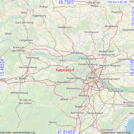
Katzelsdorf GPS coordinates[2]
48° 17' 4.416" North, 16° 6' 30.096" East
| Map corner | latitude | longitude |
|---|---|---|
| Upper-left | 48.7503°, | 15.40524° |
| Center: | 48.28456°, | 16.10836° |
| Lower-right: | 47.81453°, | 16.81149° |
| Map W x H: | 104×104 km | = 64.6×64.6mi |
| max Lat: | 48.98333° ⇑15% North |
| Katzelsdorf: | 48.28456° |
| min Lat: | ⇓85% South 46.48841° |
| min Long | Katzelsdorf | max Long |
| 9.57802° | 16.10836° | 17.1° |
| W 83.3%⇐ | ⇒16.7% E |
Elevation
Elevation of Katzelsdorf is 204 m = 669 ft, and this is 301.5 m = 989 ft below average elevation for this country.
| Max E: |
2140 m = 7021 ft | 91.6% |
| Avg. | 505.5 m = 1658 ft | |
| Katzelsdorf | 204 m = 669 ft | |
Min E: |
118 m = 387 ft | 8.4% |
See also: Austria elevation on elevation.city.
Geographical zone
Katzelsdorf is located in North temperate zone (between Tropic of Cancer and the Arctic Circle). Distance of this North polar circle is 2032.4 km =1262.9 mi to North.| Distance of | km | miles | from Katzelsdorf |
|---|---|---|---|
| North Pole | 4638.3 | 2882.1 | to North |
| Arctic Circle | 2032.4 | 1262.9 | to North |
| Tropic Cancer | 2762.8 | 1716.7 | to South |
| Equator | 5368.7 | 3336 | to South |


Nearby cities:
15 places around Katzelsdorf: (largest is in red/bold)
• Baumgarten am Tullnerfeld
5.6 km =3.5 mi,  268°
268°
• Elsbach
5.6 km =3.5 mi,  230°
230°
• Gablitz
7.1 km =4.4 mi,  151°
151°
• Kirchbach
6.6 km =4.1 mi,  88°
88°
• Königstetten
3.3 km =2.1 mi,  54°
54°
• Langenlebarn-Oberaigen
5.1 km =3.2 mi,  1°
1°
• Mauerbach
6.2 km =3.9 mi,  134°
134°
• Muckendorf an der Donau
6.3 km =3.9 mi,  33°
33°
• Riederberg
3.9 km =2.4 mi,  191°
191°
• Tulbing
1.4 km =0.9 mi, 46°
• Tulln
6.1 km =3.8 mi,  322°
322°
• Unteraigen
5.5 km =3.4 mi,  16°
16°
• Wilfersdorf
0.8 km =0.5 mi,  215°
215°
• Wolfpassing
6.1 km =3.8 mi,  58°
58°
• Zeiselmauer
7 km =4.3 mi, 45°
Sources, notices
• [Note1] Compared only with cities in Austria existing in our database
• [Src1] Map data: © OpenStreetMap contributors (CC-BY-SA)
• [Src2] Other city data from geonames.org with taken over terms of usage.
• [Src3] Geographical zone / Annual Mean Temperature by Robert A. Rohde @ Wikipedia
