Waiern geodata
Waiern (Carinthia) is a populated place; located in Austria in Europe/Vienna (GMT+2) time zone. With population of 1,028 people, there are 1248 cities with bigger population in this country. Compared to other cities in Austria, 94.2% of cities are located further ↑North; 63.3% of cities are located further →East and 70.2% of cities have lower elevation than Waiern. Note1
Administrative division(s):
- Level 1: Carinthia
- Level 2: Politischer Bezirk Feldkirchen
- Level 3: Feldkirchen in Kärnten


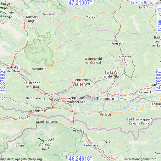
Waiern GPS coordinates[2]
46° 43' 49.008" North, 14° 4' 54.984" East
| Map corner | latitude | longitude |
|---|---|---|
| Upper-left | 47.21007°, | 13.37882° |
| Center: | 46.73028°, | 14.08194° |
| Lower-right: | 46.24618°, | 14.78507° |
| Map W x H: | 107.2×107.2 km | = 66.6×66.6mi |
| max Lat: | 48.98333° ⇑94.2% North |
| Waiern: | 46.73028° |
| min Lat: | ⇓5.8% South 46.48841° |
| min Long | Waiern | max Long |
| 9.57802° | 14.08194° | 17.1° |
| W 36.7%⇐ | ⇒63.3% E |
Elevation
Elevation of Waiern is 590 m = 1936 ft, and this is 84.5 m = 277 ft above average elevation for this country.
| Max E: |
2140 m = 7021 ft | 29.8% |
| Waiern | 590 m 1936 ft | |
| Avg. | 505.5 m = 1658 ft | |
Min E: |
118 m = 387 ft | 70.2% |
See also: Austria elevation on elevation.city.
Geographical zone
Waiern is located in North temperate zone (between Tropic of Cancer and the Arctic Circle). Distance of this North polar circle is 2205.3 km =1370.3 mi to North.| Distance of | km | miles | from Waiern |
|---|---|---|---|
| North Pole | 4811.1 | 2989.5 | to North |
| Arctic Circle | 2205.3 | 1370.3 | to North |
| Tropic Cancer | 2590 | 1609.4 | to South |
| Equator | 5195.9 | 3228.6 | to South |


Nearby cities:
15 places around Waiern: (largest is in red/bold)
• Bodensdorf
9.5 km =5.9 mi,  242°
242°
• Draschen
4.5 km =2.8 mi,  345°
345°
• Feldkirchen in Kärnten
1.3 km =0.8 mi,  124°
124°
• Fresen
4 km =2.5 mi,  225°
225°
• Glanegg
9 km =5.6 mi,  95°
95°
• Himmelberg
4.9 km =3 mi,  306°
306°
• Lindl
1.9 km =1.2 mi,  148°
148°
• Markstein
4.5 km =2.8 mi, 147°
• Mautbrücken
8.6 km =5.3 mi, 97°
• Ossiach
9.7 km =6 mi, 230°
• Sankt Ruprecht
1.7 km =1.1 mi,  91°
91°
• Sankt Ulrich
3.4 km =2.1 mi,  50°
50°
• Seitenberg
2 km =1.2 mi,  13°
13°
• Steindorf am Ossiacher See
6.6 km =4.1 mi, 237°
• Steuerberg
6.8 km =4.2 mi,  20°
20°
Sources, notices
• [Note1] Compared only with cities in Austria existing in our database
• [Src1] Map data: © OpenStreetMap contributors (CC-BY-SA)
• [Src2] Other city data from geonames.org with taken over terms of usage.
• [Src3] Geographical zone / Annual Mean Temperature by Robert A. Rohde @ Wikipedia
