Ossiach geodata
Ossiach (Carinthia) is a seat of a third-order administrative division; located in Austria in Europe/Vienna (GMT+2) time zone. With population of 116 people, there are 2919 cities with bigger population in this country. Compared to other cities in Austria, 96.2% of cities are located further ↑North; 65.3% of cities are located further →East and 59.7% of cities have lower elevation than Ossiach. Note1
Administrative division(s):
- Level 1: Carinthia
- Level 2: Politischer Bezirk Feldkirchen
- Level 3: Ossiach


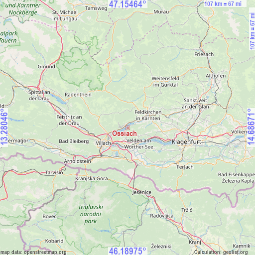
Ossiach GPS coordinates[2]
46° 40' 27.66" North, 13° 59' 0.888" East
| Map corner | latitude | longitude |
|---|---|---|
| Upper-left | 47.15464°, | 13.28046° |
| Center: | 46.67435°, | 13.98358° |
| Lower-right: | 46.18975°, | 14.68671° |
| Map W x H: | 107.3×107.3 km | = 66.7×66.7mi |
| max Lat: | 48.98333° ⇑96.2% North |
| Ossiach: | 46.67435° |
| min Lat: | ⇓3.8% South 46.48841° |
| min Long | Ossiach | max Long |
| 9.57802° | 13.98358° | 17.1° |
| W 34.7%⇐ | ⇒65.3% E |
Elevation
Elevation of Ossiach is 516 m = 1693 ft, and this is 10.5 m = 34 ft above average elevation for this country.
| Max E: |
2140 m = 7021 ft | 40.3% |
| Ossiach | 516 m 1693 ft | |
| Avg. | 505.5 m = 1658 ft | |
Min E: |
118 m = 387 ft | 59.7% |
See also: Austria elevation on elevation.city.
Geographical zone
Ossiach is located in North temperate zone (between Tropic of Cancer and the Arctic Circle). Distance of this North polar circle is 2211.5 km =1374.2 mi to North.| Distance of | km | miles | from Ossiach |
|---|---|---|---|
| North Pole | 4817.4 | 2993.4 | to North |
| Arctic Circle | 2211.5 | 1374.2 | to North |
| Tropic Cancer | 2583.8 | 1605.5 | to South |
| Equator | 5189.7 | 3224.7 | to South |


Nearby cities:
15 places around Ossiach: (largest is in red/bold)
• Annenheim
6.6 km =4.1 mi,  255°
255°
• Bodensdorf
2.1 km =1.3 mi,  332°
332°
• Fresen
5.8 km =3.6 mi,  53°
53°
• Föderlach I
8.4 km =5.2 mi,  191°
191°
• Kaltschach
6.9 km =4.3 mi,  201°
201°
• Lind ob Velden
8.2 km =5.1 mi,  169°
169°
• Sankt Andrä
7.7 km =4.8 mi,  244°
244°
• Sankt Ulrich
8.9 km =5.5 mi,  215°
215°
• Schleben
7.1 km =4.4 mi,  212°
212°
• Selpritsch
8.9 km =5.5 mi,  158°
158°
• Steindorf am Ossiacher See
3.3 km =2.1 mi,  36°
36°
• Tschöran
1.8 km =1.1 mi,  287°
287°
• Velden am Wörthersee
8.1 km =5 mi,  147°
147°
• Wernberg
7.5 km =4.7 mi, 210°
• Wudmath
8.7 km =5.4 mi,  181°
181°
Sources, notices
• [Note1] Compared only with cities in Austria existing in our database
• [Src1] Map data: © OpenStreetMap contributors (CC-BY-SA)
• [Src2] Other city data from geonames.org with taken over terms of usage.
• [Src3] Geographical zone / Annual Mean Temperature by Robert A. Rohde @ Wikipedia
