Suetschach geodata
Suetschach (Carinthia) is a populated place; located in Austria in Europe/Vienna (GMT+2) time zone. With population of 609 people, there are 2107 cities with bigger population in this country. Compared to other cities in Austria, 99.9% of cities are located further ↑North; 61.6% of cities are located further →East and 51.5% of cities have lower elevation than Suetschach. Note1
Administrative division(s):
- Level 1: Carinthia
- Level 2: Politischer Bezirk Klagenfurt Land
- Level 3: Feistritz im Rosental


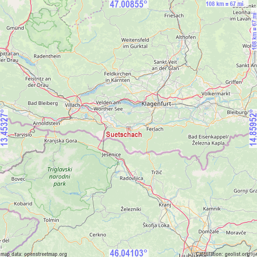
Suetschach GPS coordinates[2]
46° 31' 36.984" North, 14° 9' 23.004" East
| Map corner | latitude | longitude |
|---|---|---|
| Upper-left | 47.00855°, | 13.45327° |
| Center: | 46.52694°, | 14.15639° |
| Lower-right: | 46.04103°, | 14.85952° |
| Map W x H: | 107.6×107.6 km | = 66.9×66.9mi |
| max Lat: | 48.98333° ⇑99.9% North |
| Suetschach: | 46.52694° |
| min Lat: | ⇓0.1% South 46.48841° |
| min Long | Suetschach | max Long |
| 9.57802° | 14.15639° | 17.1° |
| W 38.4%⇐ | ⇒61.6% E |
Elevation
Elevation of Suetschach is 459 m = 1506 ft, and this is 46.5 m = 153 ft below average elevation for this country.
| Max E: |
2140 m = 7021 ft | 48.5% |
| Avg. | 505.5 m = 1658 ft | |
| Suetschach | 459 m = 1506 ft | |
Min E: |
118 m = 387 ft | 51.5% |
See also: Austria elevation on elevation.city.
Geographical zone
Suetschach is located in North temperate zone (between Tropic of Cancer and the Arctic Circle). Distance of this North polar circle is 2227.9 km =1384.4 mi to North.| Distance of | km | miles | from Suetschach |
|---|---|---|---|
| North Pole | 4833.8 | 3003.6 | to North |
| Arctic Circle | 2227.9 | 1384.4 | to North |
| Tropic Cancer | 2567.4 | 1595.3 | to South |
| Equator | 5173.3 | 3214.5 | to South |


Nearby cities:
15 places around Suetschach: (largest is in red/bold)
• Feistritz im Rosental
1.4 km =0.9 mi,  145°
145°
• Ferlach
11.1 km =6.9 mi,  90°
90°
• Keutschach am See
7.8 km =4.8 mi,  18°
18°
• Krumpendorf
12.7 km =7.9 mi, 21°
• Köttmannsdorf
7.1 km =4.4 mi,  57°
57°
• Ludmannsdorf
2.3 km =1.4 mi,  313°
313°
• Maria Elend
5.4 km =3.4 mi,  276°
276°
• Maria Rain
11.1 km =6.9 mi,  74°
74°
• Maria Wörth
10 km =6.2 mi,  2°
2°
• Pörtschach am Wörthersee
12.2 km =7.6 mi,  356°
356°
• Reifnitz
9.1 km =5.7 mi,  12°
12°
• Rosegg
12.6 km =7.8 mi,  302°
302°
• Sankt Jakob
7.9 km =4.9 mi,  286°
286°
• Schiefling am See
9.7 km =6 mi,  332°
332°
• Viktring
11.3 km =7 mi,  50°
50°
Sources, notices
• [Note1] Compared only with cities in Austria existing in our database
• [Src1] Map data: © OpenStreetMap contributors (CC-BY-SA)
• [Src2] Other city data from geonames.org with taken over terms of usage.
• [Src3] Geographical zone / Annual Mean Temperature by Robert A. Rohde @ Wikipedia
