Krumpendorf geodata
Krumpendorf (Carinthia) is a populated place; located in Austria in Europe/Vienna (GMT+2) time zone. With population of 3,264 people, there are 338 cities with bigger population in this country. Compared to other cities in Austria, 97% of cities are located further ↑North; 60.2% of cities are located further →East and 72.3% of cities have lower elevation than Krumpendorf. Note1
Administrative division(s):
- Level 1: Carinthia
- Level 2: Politischer Bezirk Klagenfurt Land
- Level 3: Krumpendorf am Wörthersee


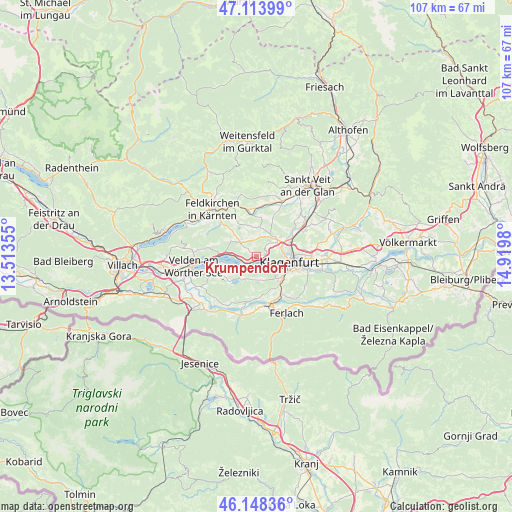
Krumpendorf GPS coordinates[2]
46° 37' 59.988" North, 14° 13' 0.012" East
| Map corner | latitude | longitude |
|---|---|---|
| Upper-left | 47.11399°, | 13.51355° |
| Center: | 46.63333°, | 14.21667° |
| Lower-right: | 46.14836°, | 14.9198° |
| Map W x H: | 107.4×107.4 km | = 66.7×66.7mi |
| max Lat: | 48.98333° ⇑97% North |
| Krumpendorf: | 46.63333° |
| min Lat: | ⇓3% South 46.48841° |
| min Long | Krumpendorf | max Long |
| 9.57802° | 14.21667° | 17.1° |
| W 39.8%⇐ | ⇒60.2% E |
Elevation
Elevation of Krumpendorf is 615 m = 2018 ft, and this is 109.5 m = 359 ft above average elevation for this country.
| Max E: |
2140 m = 7021 ft | 27.7% |
| Krumpendorf | 615 m 2018 ft | |
| Avg. | 505.5 m = 1658 ft | |
Min E: |
118 m = 387 ft | 72.3% |
See also: Austria elevation on elevation.city.
Geographical zone
Krumpendorf is located in North temperate zone (between Tropic of Cancer and the Arctic Circle). Distance of this North polar circle is 2216 km =1377 mi to North.| Distance of | km | miles | from Krumpendorf |
|---|---|---|---|
| North Pole | 4821.9 | 2996.2 | to North |
| Arctic Circle | 2216 | 1377 | to North |
| Tropic Cancer | 2579.2 | 1602.6 | to South |
| Equator | 5185.1 | 3221.9 | to South |


Nearby cities:
15 places around Krumpendorf: (largest is in red/bold)
• 2.Bezirk
7.1 km =4.4 mi,  97°
97°
• 4.Bezirk
6.9 km =4.3 mi, 100°
• Innere Stadt
7 km =4.3 mi, 98°
• Keutschach am See
5 km =3.1 mi,  205°
205°
• Klagenfurt am Wörthersee
6.8 km =4.2 mi, 98°
• Maria Wörth
4.5 km =2.8 mi,  245°
245°
• Moosburg
4.2 km =2.6 mi,  310°
310°
• Pörtschach am Wörthersee
5.4 km =3.4 mi,  273°
273°
• Reifnitz
3.9 km =2.4 mi,  222°
222°
• Sankt Martin
5.4 km =3.4 mi,  109°
109°
• Sankt Peter
4.5 km =2.8 mi,  325°
325°
• St. Veiter Vorstadt
6.8 km =4.2 mi,  91°
91°
• Viktring
6.1 km =3.8 mi,  138°
138°
• Villacher Vorstadt
5.6 km =3.5 mi, 101°
• Wölfnitz
4.8 km =3 mi,  40°
40°
Sources, notices
• [Note1] Compared only with cities in Austria existing in our database
• [Src1] Map data: © OpenStreetMap contributors (CC-BY-SA)
• [Src2] Other city data from geonames.org with taken over terms of usage.
• [Src3] Geographical zone / Annual Mean Temperature by Robert A. Rohde @ Wikipedia
