Stumm geodata
Stumm (Tyrol) is a seat of a third-order administrative division; located in Austria in Europe/Vienna (GMT+2) time zone. With population of 1,885 people, there are 659 cities with bigger population in this country. Compared to other cities in Austria, 66.1% of cities are located further ↑North; 89.1% of cities are located further →East and 65.7% of cities have lower elevation than Stumm. Note1


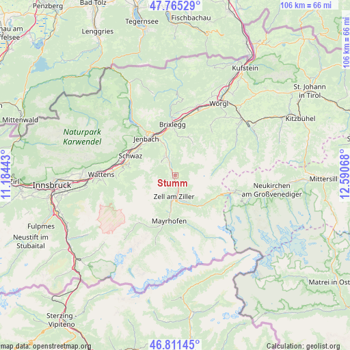
Stumm GPS coordinates[2]
47° 17' 25.872" North, 11° 53' 15.18" East
| Map corner | latitude | longitude |
|---|---|---|
| Upper-left | 47.76529°, | 11.18443° |
| Center: | 47.29052°, | 11.88755° |
| Lower-right: | 46.81145°, | 12.59068° |
| Map W x H: | 106.1×106.1 km | = 65.9×65.9mi |
| max Lat: | 48.98333° ⇑66.1% North |
| Stumm: | 47.29052° |
| min Lat: | ⇓33.9% South 46.48841° |
| min Long | Stumm | max Long |
| 9.57802° | 11.88755° | 17.1° |
| W 10.9%⇐ | ⇒89.1% E |
Elevation
Elevation of Stumm is 557 m = 1827 ft, and this is 51.5 m = 169 ft above average elevation for this country.
| Max E: |
2140 m = 7021 ft | 34.3% |
| Stumm | 557 m 1827 ft | |
| Avg. | 505.5 m = 1658 ft | |
Min E: |
118 m = 387 ft | 65.7% |
See also: Austria elevation on elevation.city.
Geographical zone
Stumm is located in North temperate zone (between Tropic of Cancer and the Arctic Circle). Distance of this North polar circle is 2143 km =1331.6 mi to North.| Distance of | km | miles | from Stumm |
|---|---|---|---|
| North Pole | 4748.8 | 2950.8 | to North |
| Arctic Circle | 2143 | 1331.6 | to North |
| Tropic Cancer | 2652.3 | 1648.1 | to South |
| Equator | 5258.2 | 3267.3 | to South |


Nearby cities:
15 places around Stumm: (largest is in red/bold)
• Aschau
2.8 km =1.7 mi,  160°
160°
• Aschau im Zillertal
2.8 km =1.7 mi,  167°
167°
• Finsing
4.5 km =2.8 mi,  332°
332°
• Fügen
6.9 km =4.3 mi,  335°
335°
• Hart im Zillertal
6.9 km =4.3 mi,  345°
345°
• Helfenstein
5 km =3.1 mi, 341°
• Kaltenbach
1.8 km =1.1 mi,  243°
243°
• Kapfing
5.5 km =3.4 mi, 329°
• Pankrazberg
6.1 km =3.8 mi,  298°
298°
• Ried im Zillertal
1.9 km =1.2 mi, 303°
• Rohrberg
6.7 km =4.2 mi, 160°
• Stummerberg
2.3 km =1.4 mi,  110°
110°
• Uderns
3.3 km =2.1 mi, 331°
• Zell am Ziller
6.4 km =4 mi,  182°
182°
• Zellberg
7 km =4.3 mi,  204°
204°
Sources, notices
• [Note1] Compared only with cities in Austria existing in our database
• [Src1] Map data: © OpenStreetMap contributors (CC-BY-SA)
• [Src2] Other city data from geonames.org with taken over terms of usage.
• [Src3] Geographical zone / Annual Mean Temperature by Robert A. Rohde @ Wikipedia
