Staudach geodata
Staudach (Styria) is a populated place; located in Austria in Europe/Vienna (GMT+1) time zone. With population of 824 people, there are 1570 cities with bigger population in this country. Compared to other cities in Austria, 64.6% of cities are located further ↑North; 78.8% of cities are located further ←West and 54.5% of cities have lower elevation than Staudach. Note1
Administrative division(s):
- Level 1: Styria
- Level 2: Politischer Bezirk Hartberg-Fürstenfeld
- Level 3: Greinbach


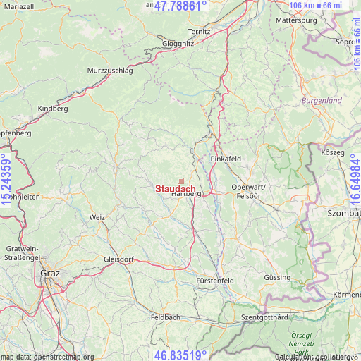
Staudach GPS coordinates[2]
47° 18' 50.58" North, 15° 56' 48.156" East
| Map corner | latitude | longitude |
|---|---|---|
| Upper-left | 47.78861°, | 15.24359° |
| Center: | 47.31405°, | 15.94671° |
| Lower-right: | 46.83519°, | 16.64984° |
| Map W x H: | 106×106 km | = 65.9×65.9mi |
| max Lat: | 48.98333° ⇑64.6% North |
| Staudach: | 47.31405° |
| min Lat: | ⇓35.4% South 46.48841° |
| min Long | Staudach | max Long |
| 9.57802° | 15.94671° | 17.1° |
| W 78.8%⇐ | ⇒21.2% E |
Elevation
Elevation of Staudach is 480 m = 1575 ft, and this is 25.5 m = 84 ft below average elevation for this country.
| Max E: |
2140 m = 7021 ft | 45.5% |
| Avg. | 505.5 m = 1658 ft | |
| Staudach | 480 m = 1575 ft | |
Min E: |
118 m = 387 ft | 54.5% |
See also: Austria elevation on elevation.city.
Geographical zone
Staudach is located in North temperate zone (between Tropic of Cancer and the Arctic Circle). Distance of this North polar circle is 2140.3 km =1329.9 mi to North.| Distance of | km | miles | from Staudach |
|---|---|---|---|
| North Pole | 4746.2 | 2949.2 | to North |
| Arctic Circle | 2140.3 | 1329.9 | to North |
| Tropic Cancer | 2654.9 | 1649.7 | to South |
| Equator | 5260.8 | 3268.9 | to South |


Nearby cities:
15 places around Staudach: (largest is in red/bold)
• Eggendorf
4.9 km =3 mi,  113°
113°
• Flattendorf
5.7 km =3.5 mi,  203°
203°
• Grafendorf bei Hartberg
4.4 km =2.7 mi,  48°
48°
• Hartberg
3.7 km =2.3 mi,  156°
156°
• Löffelbach
3.6 km =2.2 mi, 196°
• Oberneuberg
6 km =3.7 mi,  272°
272°
• Penzendorf
2.2 km =1.4 mi,  136°
136°
• Pongrazen bei Hartberg
4.2 km =2.6 mi,  318°
318°
• Pöllauberg
7.3 km =4.5 mi, 272°
• Ring
3.3 km =2.1 mi, 156°
• Safenau
5.9 km =3.7 mi,  152°
152°
• Sankt Johann in der Haide
7 km =4.3 mi,  121°
121°
• Seibersdorf am Hammerwald
3.6 km =2.2 mi,  65°
65°
• Stambach
2.4 km =1.5 mi,  334°
334°
• Unterneuberg
7.3 km =4.5 mi, 272°
Sources, notices
• [Note1] Compared only with cities in Austria existing in our database
• [Src1] Map data: © OpenStreetMap contributors (CC-BY-SA)
• [Src2] Other city data from geonames.org with taken over terms of usage.
• [Src3] Geographical zone / Annual Mean Temperature by Robert A. Rohde @ Wikipedia
