Hartberg geodata
Hartberg (Styria) is a seat of a third-order administrative division; located in Austria in Europe/Vienna (GMT+2) time zone. With population of 4,170 people, there are 245 cities with bigger population in this country. Compared to other cities in Austria, 67.2% of cities are located further ↑North; 79.4% of cities are located further ←West and 58.2% of cities have higher elevation than Hartberg. Note1
Administrative division(s):
- Level 1: Styria
- Level 2: Politischer Bezirk Hartberg-Fürstenfeld
- Level 3: Hartberg


Hartberg GPS coordinates[2]
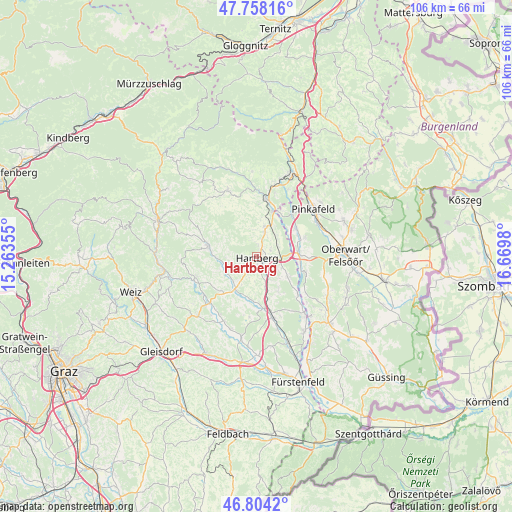
47° 16' 59.988" North, 15° 58' 0.012" East
| Map corner | latitude | longitude |
|---|---|---|
| Upper-left | 47.75816°, | 15.26355° |
| Center: | 47.28333°, | 15.96667° |
| Lower-right: | 46.8042°, | 16.6698° |
| Map W x H: | 106.1×106.1 km | = 65.9×65.9mi |
| max Lat: | 48.98333° ⇑67.2% North |
| Hartberg: | 47.28333° |
| min Lat: | ⇓32.8% South 46.48841° |
| min Long | Hartberg | max Long |
| 9.57802° | 15.96667° | 17.1° |
| W 79.4%⇐ | ⇒20.6% E |
Elevation
Elevation of Hartberg is 396 m = 1299 ft, and this is 109.5 m = 359 ft below average elevation for this country.
| Max E: |
2140 m = 7021 ft | 58.2% |
| Avg. | 505.5 m = 1658 ft | |
| Hartberg | 396 m = 1299 ft | |
Min E: |
118 m = 387 ft | 41.8% |
See also: Austria elevation on elevation.city.
Geographical zone
Hartberg is located in North temperate zone (between Tropic of Cancer and the Arctic Circle). Distance of this North polar circle is 2143.8 km =1332.1 mi to North.| Distance of | km | miles | from Hartberg |
|---|---|---|---|
| North Pole | 4749.6 | 2951.3 | to North |
| Arctic Circle | 2143.8 | 1332.1 | to North |
| Tropic Cancer | 2651.5 | 1647.6 | to South |
| Equator | 5257.4 | 3266.8 | to South |


Nearby cities:
15 places around Hartberg: (largest is in red/bold)
• Dienersdorf
6.9 km =4.3 mi,  225°
225°
• Eggendorf
3.3 km =2.1 mi,  64°
64°
• Flattendorf
4.2 km =2.6 mi,  243°
243°
• Grafendorf bei Hartberg
6.6 km =4.1 mi,  15°
15°
• Hofkirchen
7 km =4.3 mi, 232°
• Löffelbach
2.5 km =1.6 mi,  270°
270°
• Penzendorf
1.9 km =1.2 mi,  0°
0°
• Ring
0.4 km =0.2 mi,  337°
337°
• Safenau
2.2 km =1.4 mi,  145°
145°
• Sankt Johann in der Haide
4.5 km =2.8 mi,  93°
93°
• Seibersdorf am Hammerwald
5.2 km =3.2 mi, 20°
• Stambach
6.1 km =3.8 mi, 335°
• Staudach
3.7 km =2.3 mi, 336°
• Unterbuch
6.5 km =4 mi,  164°
164°
• Unterrohr
7.3 km =4.5 mi,  120°
120°
Sources, notices
• [Note1] Compared only with cities in Austria existing in our database
• [Src1] Map data: © OpenStreetMap contributors (CC-BY-SA)
• [Src2] Other city data from geonames.org with taken over terms of usage.
• [Src3] Geographical zone / Annual Mean Temperature by Robert A. Rohde @ Wikipedia
