Grafendorf bei Hartberg geodata
Grafendorf bei Hartberg (Styria) is a seat of a third-order administrative division; located in Austria in Europe/Vienna (GMT+2) time zone. With population of 1,047 people, there are 1221 cities with bigger population in this country. Compared to other cities in Austria, 63.1% of cities are located further ↑North; 80% of cities are located further ←West and 60.3% of cities have higher elevation than Grafendorf bei Hartberg. Note1
Administrative division(s):
- Level 1: Styria
- Level 2: Politischer Bezirk Hartberg-Fürstenfeld
- Level 3: Grafendorf bei Hartberg
Current local time in Grafendorf bei Hartberg:
11:58 PM, FridayDifference from your time zone: hours


Grafendorf bei Hartberg GPS coordinates[2]
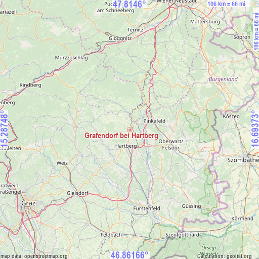
47° 20' 25.008" North, 15° 59' 26.16" East
| Map corner | latitude | longitude |
|---|---|---|
| Upper-left | 47.8146°, | 15.28748° |
| Center: | 47.34028°, | 15.9906° |
| Lower-right: | 46.86166°, | 16.69373° |
| Map W x H: | 106×106 km | = 65.9×65.9mi |
| max Lat: | 48.98333° ⇑63.1% North |
| Grafendorf bei Hartberg: | 47.34028° |
| min Lat: | ⇓36.9% South 46.48841° |
| min Long | Grafendorf bei | max Long |
| 9.57802° | 15.9906° | 17.1° |
| W 80%⇐ | ⇒20% E |
Elevation
Elevation of Grafendorf bei Hartberg is 381 m = 1250 ft, and this is 124.5 m = 408 ft below average elevation for this country.
| Max E: |
2140 m = 7021 ft | 60.3% |
| Avg. | 505.5 m = 1658 ft | |
| Grafendorf bei Hartberg | 381 m = 1250 ft | |
Min E: |
118 m = 387 ft | 39.7% |
See also: Austria elevation on elevation.city.
Geographical zone
Grafendorf bei Hartberg is located in North temperate zone (between Tropic of Cancer and the Arctic Circle). Distance of this North polar circle is 2137.4 km =1328.1 mi to North.| Distance of | km | miles | from Grafendorf bei Hartberg |
|---|---|---|---|
| North Pole | 4743.3 | 2947.3 | to North |
| Arctic Circle | 2137.4 | 1328.1 | to North |
| Tropic Cancer | 2657.8 | 1651.5 | to South |
| Equator | 5263.7 | 3270.7 | to South |


Nearby cities:
15 places around Grafendorf bei Hartberg: (largest is in red/bold)
• Eggendorf
5 km =3.1 mi,  166°
166°
• Eichberg
4.8 km =3 mi,  344°
344°
• Grafenschachen
6.4 km =4 mi,  62°
62°
• Hartberg
6.6 km =4.1 mi,  195°
195°
• Lafnitz
3.4 km =2.1 mi,  26°
26°
• Loipersdorf im Burgenland
7 km =4.3 mi,  96°
96°
• Neustift an der Lafnitz
4.4 km =2.7 mi,  47°
47°
• Penzendorf
4.8 km =3 mi, 201°
• Pongrazen bei Hartberg
6.1 km =3.8 mi,  271°
271°
• Ring
6.3 km =3.9 mi, 198°
• Rohrbach an der Lafnitz
4.8 km =3 mi,  8°
8°
• Sankt Johann in der Haide
7.1 km =4.4 mi,  158°
158°
• Seibersdorf am Hammerwald
1.4 km =0.9 mi,  179°
179°
• Stambach
4.4 km =2.7 mi,  259°
259°
• Staudach
4.4 km =2.7 mi,  228°
228°
In other languages:
- In Russian: Графендорф (Хартберг), Графендорф-бай-Хартберг
- In Chinese: 哈特贝格附近格拉芬多夫
Sources, notices
• [Note1] Compared only with cities in Austria existing in our database
• [Src1] Map data: © OpenStreetMap contributors (CC-BY-SA)
• [Src2] Other city data from geonames.org with taken over terms of usage.
• [Src3] Geographical zone / Annual Mean Temperature by Robert A. Rohde @ Wikipedia
