Seeham geodata
Seeham (Salzburg) is a seat of a third-order administrative division; located in Austria in Europe/Vienna (GMT+2) time zone. With population of 1,354 people, there are 932 cities with bigger population in this country. Compared to other cities in Austria, 64.4% of cities are located further ↓South; 81.9% of cities are located further →East and 59.1% of cities have lower elevation than Seeham. Note1
Administrative division(s):
- Level 1: Salzburg
- Level 2: Politischer Bezirk Salzburg-Umgebung
- Level 3: Seeham


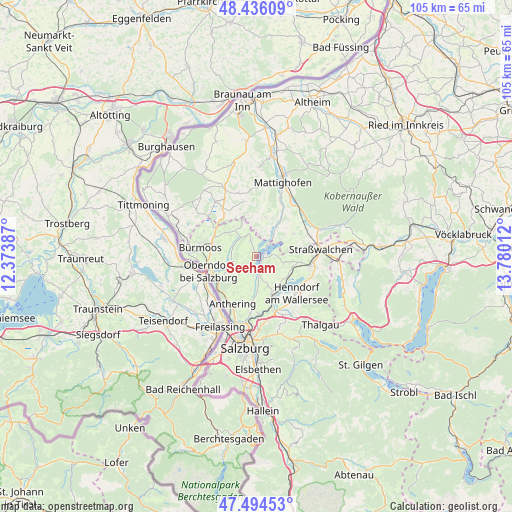
Seeham GPS coordinates[2]
47° 58' 2.856" North, 13° 4' 37.164" East
| Map corner | latitude | longitude |
|---|---|---|
| Upper-left | 48.43609°, | 12.37387° |
| Center: | 47.96746°, | 13.07699° |
| Lower-right: | 47.49453°, | 13.78012° |
| Map W x H: | 104.7×104.7 km | = 65.1×65.1mi |
| max Lat: | 48.98333° ⇑35.6% North |
| Seeham: | 47.96746° |
| min Lat: | ⇓64.4% South 46.48841° |
| min Long | Seeham | max Long |
| 9.57802° | 13.07699° | 17.1° |
| W 18.1%⇐ | ⇒81.9% E |
Elevation
Elevation of Seeham is 512 m = 1680 ft, and this is 6.5 m = 21 ft above average elevation for this country.
| Max E: |
2140 m = 7021 ft | 40.9% |
| Seeham | 512 m 1680 ft | |
| Avg. | 505.5 m = 1658 ft | |
Min E: |
118 m = 387 ft | 59.1% |
See also: Austria elevation on elevation.city.
Geographical zone
Seeham is located in North temperate zone (between Tropic of Cancer and the Arctic Circle). Distance of this North polar circle is 2067.7 km =1284.8 mi to North.| Distance of | km | miles | from Seeham |
|---|---|---|---|
| North Pole | 4673.6 | 2904 | to North |
| Arctic Circle | 2067.7 | 1284.8 | to North |
| Tropic Cancer | 2727.6 | 1694.9 | to South |
| Equator | 5333.5 | 3314.1 | to South |


Nearby cities:
15 places around Seeham: (largest is in red/bold)
• Berndorf bei Salzburg
3.3 km =2.1 mi,  339°
339°
• Dorfbeuern
7.1 km =4.4 mi,  320°
320°
• Lochen
8.9 km =5.5 mi,  59°
59°
• Mattsee
1.7 km =1.1 mi,  92°
92°
• Matzing
2.1 km =1.3 mi,  201°
201°
• Mühlbach
7.2 km =4.5 mi,  218°
218°
• Nußdorf am Haunsberg
5.1 km =3.2 mi,  259°
259°
• Obertrum am See
3.4 km =2.1 mi,  179°
179°
• Palting
6.5 km =4 mi,  34°
34°
• Perwang am Grabensee
4.4 km =2.7 mi,  5°
5°
• Schleedorf
5.8 km =3.6 mi,  109°
109°
• Seekirchen am Wallersee
8.6 km =5.3 mi,  150°
150°
• Seewalchen
8.6 km =5.3 mi, 150°
• Wagnergraben
7.1 km =4.4 mi,  326°
326°
• Waldprechting
8.1 km =5 mi,  158°
158°
Sources, notices
• [Note1] Compared only with cities in Austria existing in our database
• [Src1] Map data: © OpenStreetMap contributors (CC-BY-SA)
• [Src2] Other city data from geonames.org with taken over terms of usage.
• [Src3] Geographical zone / Annual Mean Temperature by Robert A. Rohde @ Wikipedia
