Schrattenberg geodata
Schrattenberg (Lower Austria) is a seat of a third-order administrative division; located in Austria in Europe/Vienna (GMT+1) time zone. With population of 810 people, there are 1593 cities with bigger population in this country. Compared to other cities in Austria, 98.6% of cities are located further ↓South; 97.6% of cities are located further ←West and 92% of cities have higher elevation than Schrattenberg. Note1
Administrative division(s):
- Level 1: Lower Austria
- Level 2: Politischer Bezirk Mistelbach
- Level 3: Schrattenberg


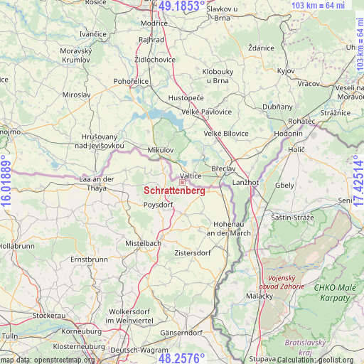
Schrattenberg GPS coordinates[2]
48° 43' 24.924" North, 16° 43' 19.236" East
| Map corner | latitude | longitude |
|---|---|---|
| Upper-left | 49.1853°, | 16.01889° |
| Center: | 48.72359°, | 16.72201° |
| Lower-right: | 48.2576°, | 17.42514° |
| Map W x H: | 103.2×103.1 km | = 64.1×64.1mi |
| max Lat: | 48.98333° ⇑1.4% North |
| Schrattenberg: | 48.72359° |
| min Lat: | ⇓98.6% South 46.48841° |
| min Long | Schrattenberg | max Long |
| 9.57802° | 16.72201° | 17.1° |
| W 97.6%⇐ | ⇒2.4% E |
Elevation
Elevation of Schrattenberg is 201 m = 659 ft, and this is 304.5 m = 999 ft below average elevation for this country.
| Max E: |
2140 m = 7021 ft | 92% |
| Avg. | 505.5 m = 1658 ft | |
| Schrattenberg | 201 m = 659 ft | |
Min E: |
118 m = 387 ft | 8% |
See also: Austria elevation on elevation.city.
Geographical zone
Schrattenberg is located in North temperate zone (between Tropic of Cancer and the Arctic Circle). Distance of this North polar circle is 1983.6 km =1232.6 mi to North.| Distance of | km | miles | from Schrattenberg |
|---|---|---|---|
| North Pole | 4589.5 | 2851.8 | to North |
| Arctic Circle | 1983.6 | 1232.6 | to North |
| Tropic Cancer | 2811.6 | 1747 | to South |
| Equator | 5417.6 | 3366.3 | to South |


Nearby cities:
15 places around Schrattenberg: (largest is in red/bold)
• Altlichtenwarth
10.4 km =6.5 mi,  148°
148°
• Bernhardsthal
11.4 km =7.1 mi,  108°
108°
• Bullendorf
16.1 km =10 mi,  194°
194°
• Dobermannsdorf
15.4 km =9.6 mi, 153°
• Drasenhofen
6 km =3.7 mi,  299°
299°
• Falkenstein
10.2 km =6.3 mi,  265°
265°
• Großkrut
8.9 km =5.5 mi,  179°
179°
• Hausbrunn
13.4 km =8.3 mi,  144°
144°
• Hauskirchen
14.1 km =8.8 mi,  166°
166°
• Herrnbaumgarten
4.2 km =2.6 mi,  223°
223°
• Neusiedl an der Zaya
14.5 km =9 mi,  162°
162°
• Ottenthal
11.3 km =7 mi,  291°
291°
• Poysdorf
9.1 km =5.7 mi,  225°
225°
• Rabensburg
15.4 km =9.6 mi,  122°
122°
• Wildendürnbach
16.5 km =10.3 mi,  282°
282°
Sources, notices
• [Note1] Compared only with cities in Austria existing in our database
• [Src1] Map data: © OpenStreetMap contributors (CC-BY-SA)
• [Src2] Other city data from geonames.org with taken over terms of usage.
• [Src3] Geographical zone / Annual Mean Temperature by Robert A. Rohde @ Wikipedia
