Hausbrunn geodata
Hausbrunn (Lower Austria) is a seat of a third-order administrative division; located in Austria in Europe/Vienna (GMT+2) time zone. With population of 857 people, there are 1506 cities with bigger population in this country. Compared to other cities in Austria, 97% of cities are located further ↓South; 98.6% of cities are located further ←West and 94.4% of cities have higher elevation than Hausbrunn. Note1
Administrative division(s):
- Level 1: Lower Austria
- Level 2: Politischer Bezirk Mistelbach
- Level 3: Hausbrunn


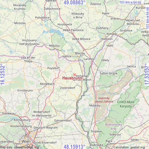
Hausbrunn GPS coordinates[2]
48° 37' 33.672" North, 16° 49' 42.384" East
| Map corner | latitude | longitude |
|---|---|---|
| Upper-left | 49.08863°, | 16.12532° |
| Center: | 48.62602°, | 16.82844° |
| Lower-right: | 48.15913°, | 17.53157° |
| Map W x H: | 103.4×103.3 km | = 64.2×64.2mi |
| max Lat: | 48.98333° ⇑3% North |
| Hausbrunn: | 48.62602° |
| min Lat: | ⇓97% South 46.48841° |
| min Long | Hausbrunn | max Long |
| 9.57802° | 16.82844° | 17.1° |
| W 98.6%⇐ | ⇒1.4% E |
Elevation
Elevation of Hausbrunn is 183 m = 600 ft, and this is 322.5 m = 1058 ft below average elevation for this country.
| Max E: |
2140 m = 7021 ft | 94.4% |
| Avg. | 505.5 m = 1658 ft | |
| Hausbrunn | 183 m = 600 ft | |
Min E: |
118 m = 387 ft | 5.6% |
See also: Austria elevation on elevation.city.
Geographical zone
Hausbrunn is located in North temperate zone (between Tropic of Cancer and the Arctic Circle). Distance of this North polar circle is 1994.5 km =1239.3 mi to North.| Distance of | km | miles | from Hausbrunn |
|---|---|---|---|
| North Pole | 4600.4 | 2858.6 | to North |
| Arctic Circle | 1994.5 | 1239.3 | to North |
| Tropic Cancer | 2800.8 | 1740.3 | to South |
| Equator | 5406.7 | 3359.6 | to South |


Nearby cities:
15 places around Hausbrunn: (largest is in red/bold)
• Altlichtenwarth
3.1 km =1.9 mi,  311°
311°
• Bernhardsthal
7.9 km =4.9 mi,  22°
22°
• Bullendorf
12.8 km =8 mi,  248°
248°
• Dobermannsdorf
3 km =1.9 mi,  196°
196°
• Drösing
11.1 km =6.9 mi,  150°
150°
• Groß-Inzersdorf
12.2 km =7.6 mi, 204°
• Großkrut
8 km =5 mi,  284°
284°
• Hauskirchen
5.4 km =3.4 mi,  237°
237°
• Hohenau
6.1 km =3.8 mi,  113°
113°
• Neusiedl an der Zaya
4.7 km =2.9 mi,  230°
230°
• Niederabsdorf
6.8 km =4.2 mi,  166°
166°
• Palterndorf
4.8 km =3 mi,  190°
190°
• Rabensburg
5.9 km =3.7 mi,  63°
63°
• Ringelsdorf
7.2 km =4.5 mi,  156°
156°
• Zistersdorf
10.5 km =6.5 mi,  207°
207°
Sources, notices
• [Note1] Compared only with cities in Austria existing in our database
• [Src1] Map data: © OpenStreetMap contributors (CC-BY-SA)
• [Src2] Other city data from geonames.org with taken over terms of usage.
• [Src3] Geographical zone / Annual Mean Temperature by Robert A. Rohde @ Wikipedia
