Schlierbach geodata
Schlierbach (Upper Austria) is a populated place; located in Austria in Europe/Vienna (GMT+2) time zone. With population of 1,773 people, there are 702 cities with bigger population in this country. Compared to other cities in Austria, 62.6% of cities are located further ↓South; 62.2% of cities are located further →East and 56.5% of cities have higher elevation than Schlierbach. Note1
Administrative division(s):
- Level 1: Upper Austria
- Level 2: Politischer Bezirk Kirchdorf an der Krems
- Level 3: Schlierbach


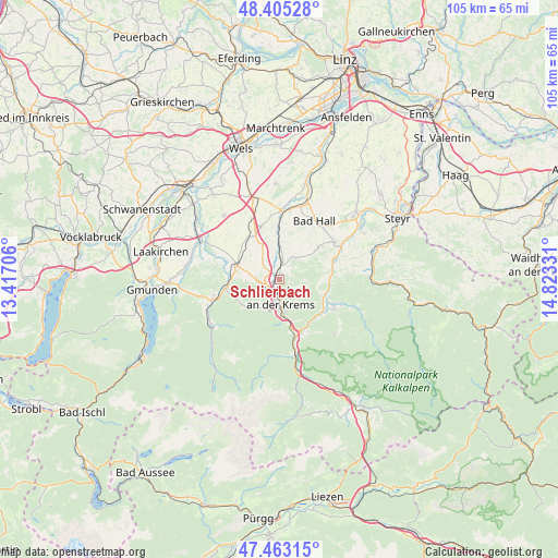
Schlierbach GPS coordinates[2]
47° 56' 10.896" North, 14° 7' 12.648" East
| Map corner | latitude | longitude |
|---|---|---|
| Upper-left | 48.40528°, | 13.41706° |
| Center: | 47.93636°, | 14.12018° |
| Lower-right: | 47.46315°, | 14.82331° |
| Map W x H: | 104.8×104.8 km | = 65.1×65.1mi |
| max Lat: | 48.98333° ⇑37.4% North |
| Schlierbach: | 47.93636° |
| min Lat: | ⇓62.6% South 46.48841° |
| min Long | Schlierbach | max Long |
| 9.57802° | 14.12018° | 17.1° |
| W 37.8%⇐ | ⇒62.2% E |
Elevation
Elevation of Schlierbach is 409 m = 1342 ft, and this is 96.5 m = 317 ft below average elevation for this country.
| Max E: |
2140 m = 7021 ft | 56.5% |
| Avg. | 505.5 m = 1658 ft | |
| Schlierbach | 409 m = 1342 ft | |
Min E: |
118 m = 387 ft | 43.5% |
See also: Austria elevation on elevation.city.
Geographical zone
Schlierbach is located in North temperate zone (between Tropic of Cancer and the Arctic Circle). Distance of this North polar circle is 2071.2 km =1287 mi to North.| Distance of | km | miles | from Schlierbach |
|---|---|---|---|
| North Pole | 4677 | 2906.2 | to North |
| Arctic Circle | 2071.2 | 1287 | to North |
| Tropic Cancer | 2724.1 | 1692.7 | to South |
| Equator | 5330 | 3311.9 | to South |


Nearby cities:
15 places around Schlierbach: (largest is in red/bold)
• Adlwang
9.6 km =6 mi,  49°
49°
• Dürndorf
8 km =5 mi,  286°
286°
• Hausmanning
2.6 km =1.6 mi,  174°
174°
• Inzersdorf im Kremstal
3.1 km =1.9 mi,  252°
252°
• Kirchdorf an der Krems
3.4 km =2.1 mi,  177°
177°
• Leonstein
9.4 km =5.8 mi,  118°
118°
• Micheldorf in Oberösterreich
6.6 km =4.1 mi, 171°
• Mitterndorf
9.3 km =5.8 mi,  282°
282°
• Nussbach
5.2 km =3.2 mi,  39°
39°
• Obergrünburg
10.2 km =6.3 mi,  80°
80°
• Pettenbach
8.1 km =5 mi, 288°
• Pratsdorf
5.9 km =3.7 mi, 290°
• Steinbach am Ziehberg
8.3 km =5.2 mi,  233°
233°
• Strienzing
4.9 km =3 mi,  345°
345°
• Wartberg an der Krems
5.9 km =3.7 mi,  358°
358°
Sources, notices
• [Note1] Compared only with cities in Austria existing in our database
• [Src1] Map data: © OpenStreetMap contributors (CC-BY-SA)
• [Src2] Other city data from geonames.org with taken over terms of usage.
• [Src3] Geographical zone / Annual Mean Temperature by Robert A. Rohde @ Wikipedia
