Obergrünburg geodata
Obergrünburg (Upper Austria) is a populated place; located in Austria in Europe/Vienna (GMT+2) time zone. With population of 514 people, there are 2453 cities with bigger population in this country. Compared to other cities in Austria, 63.6% of cities are located further ↓South; 59.2% of cities are located further →East and 61.2% of cities have higher elevation than Obergrünburg. Note1
Administrative division(s):
- Level 1: Upper Austria
- Level 2: Politischer Bezirk Kirchdorf an der Krems
- Level 3: Grünburg


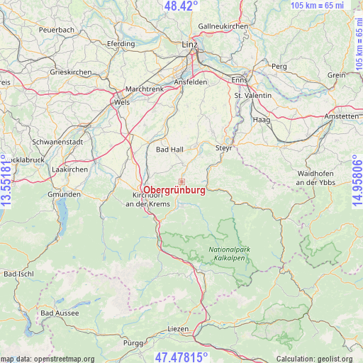
Obergrünburg GPS coordinates[2]
47° 57' 4.392" North, 14° 15' 17.748" East
| Map corner | latitude | longitude |
|---|---|---|
| Upper-left | 48.42°, | 13.55181° |
| Center: | 47.95122°, | 14.25493° |
| Lower-right: | 47.47815°, | 14.95806° |
| Map W x H: | 104.7×104.7 km | = 65.1×65.1mi |
| max Lat: | 48.98333° ⇑36.4% North |
| Obergrünburg: | 47.95122° |
| min Lat: | ⇓63.6% South 46.48841° |
| min Long | Obergrünburg | max Long |
| 9.57802° | 14.25493° | 17.1° |
| W 40.8%⇐ | ⇒59.2% E |
Elevation
Elevation of Obergrünburg is 376 m = 1234 ft, and this is 129.5 m = 425 ft below average elevation for this country.
| Max E: |
2140 m = 7021 ft | 61.2% |
| Avg. | 505.5 m = 1658 ft | |
| Obergrünburg | 376 m = 1234 ft | |
Min E: |
118 m = 387 ft | 38.8% |
See also: Austria elevation on elevation.city.
Geographical zone
Obergrünburg is located in North temperate zone (between Tropic of Cancer and the Arctic Circle). Distance of this North polar circle is 2069.5 km =1285.9 mi to North.| Distance of | km | miles | from Obergrünburg |
|---|---|---|---|
| North Pole | 4675.4 | 2905.2 | to North |
| Arctic Circle | 2069.5 | 1285.9 | to North |
| Tropic Cancer | 2725.8 | 1693.7 | to South |
| Equator | 5331.7 | 3313 | to South |


Nearby cities:
15 places around Obergrünburg: (largest is in red/bold)
• Adlwang
5.4 km =3.4 mi,  328°
328°
• Aschach an der Steyr
9.1 km =5.7 mi,  41°
41°
• Bad Hall
10.3 km =6.4 mi,  340°
340°
• Feyregg
10.1 km =6.3 mi, 330°
• Grünburg
2.5 km =1.6 mi,  17°
17°
• Leonstein
6.3 km =3.9 mi,  196°
196°
• Molln
7.1 km =4.4 mi,  178°
178°
• Nussbach
7.2 km =4.5 mi,  289°
289°
• Pfarrkirchen bei Bad Hall
9.7 km =6 mi, 334°
• Schlierbach
10.2 km =6.3 mi,  260°
260°
• Steinbach an der Steyr
2.4 km =1.5 mi,  26°
26°
• Ternberg
7.8 km =4.8 mi,  94°
94°
• Untergrünburg
2.4 km =1.5 mi, 17°
• Waldneukirchen
5.3 km =3.3 mi,  3°
3°
• Zehetner
1.7 km =1.1 mi,  60°
60°
Sources, notices
• [Note1] Compared only with cities in Austria existing in our database
• [Src1] Map data: © OpenStreetMap contributors (CC-BY-SA)
• [Src2] Other city data from geonames.org with taken over terms of usage.
• [Src3] Geographical zone / Annual Mean Temperature by Robert A. Rohde @ Wikipedia
