Sankt Michael in Obersteiermark geodata
Sankt Michael in Obersteiermark (Styria) is a seat of a third-order administrative division; located in Austria in Europe/Vienna (GMT+2) time zone. With population of 972 people, there are 1335 cities with bigger population in this country. Compared to other cities in Austria, 63.1% of cities are located further ↑North; 54.5% of cities are located further ←West and 69.1% of cities have lower elevation than Sankt Michael in Obersteiermark. Note1
Administrative division(s):
- Level 1: Styria
- Level 2: Politischer Bezirk Leoben
- Level 3: Sankt Michael in Obersteiermark
Current local time in Sankt Michael in Obersteiermark:
10:37 PM, FridayDifference from your time zone: hours


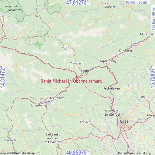
Sankt Michael in Obersteiermark GPS coordinates[2]
47° 20' 18.204" North, 15° 1' 4.224" East
| Map corner | latitude | longitude |
|---|---|---|
| Upper-left | 47.81273°, | 14.31472° |
| Center: | 47.33839°, | 15.01784° |
| Lower-right: | 46.85975°, | 15.72097° |
| Map W x H: | 106×106 km | = 65.9×65.9mi |
| max Lat: | 48.98333° ⇑63.1% North |
| Sankt Michael in Obersteiermark: | 47.33839° |
| min Lat: | ⇓36.9% South 46.48841° |
| min Long | Sankt Michael i | max Long |
| 9.57802° | 15.01784° | 17.1° |
| W 54.5%⇐ | ⇒45.5% E |
Elevation
Elevation of Sankt Michael in Obersteiermark is 581 m = 1906 ft, and this is 75.5 m = 248 ft above average elevation for this country.
| Max E: |
2140 m = 7021 ft | 30.9% |
| Sankt Michael in Obersteiermark | 581 m 1906 ft | |
| Avg. | 505.5 m = 1658 ft | |
Min E: |
118 m = 387 ft | 69.1% |
See also: Austria elevation on elevation.city.
Geographical zone
Sankt Michael in Obersteiermark is located in North temperate zone (between Tropic of Cancer and the Arctic Circle). Distance of this North polar circle is 2137.6 km =1328.2 mi to North.| Distance of | km | miles | from Sankt Michael in Obersteiermark |
|---|---|---|---|
| North Pole | 4743.5 | 2947.5 | to North |
| Arctic Circle | 2137.6 | 1328.2 | to North |
| Tropic Cancer | 2657.6 | 1651.4 | to South |
| Equator | 5263.5 | 3270.6 | to South |


Nearby cities:
15 places around Sankt Michael in Obersteiermark: (largest is in red/bold)
• Donawitz
4.8 km =3 mi,  49°
49°
• Göss
6.6 km =4.1 mi,  69°
69°
• Hessenberg
6.6 km =4.1 mi,  359°
359°
• Hinterberg
4.6 km =2.9 mi,  57°
57°
• Judendorf
9.2 km =5.7 mi,  42°
42°
• Kraubath an der Mur
7.7 km =4.8 mi,  236°
236°
• Laintal
9.8 km =6.1 mi,  9°
9°
• Leitendorf
5.9 km =3.7 mi, 57°
• Leoben
7 km =4.3 mi, 52°
• Liesingtal
0.9 km =0.6 mi,  338°
338°
• Sankt Peter-Freienstein
5 km =3.1 mi, 358°
• Sankt Stefan ob Leoben
3.8 km =2.4 mi,  231°
231°
• Timmersdorf
5.4 km =3.4 mi,  324°
324°
• Traboch
4.9 km =3 mi,  331°
331°
• Trofaiach
9.7 km =6 mi, 355°
In other languages:
- In Russian: Санкт-Михель (Верхняя Штирия), Санкт-Михаэль-ин-Оберштайермарк
- In Chinese: 上施泰尔马克地区圣米夏埃尔
Sources, notices
• [Note1] Compared only with cities in Austria existing in our database
• [Src1] Map data: © OpenStreetMap contributors (CC-BY-SA)
• [Src2] Other city data from geonames.org with taken over terms of usage.
• [Src3] Geographical zone / Annual Mean Temperature by Robert A. Rohde @ Wikipedia
