Sankt Gallenkirch geodata
Sankt Gallenkirch (Vorarlberg) is a seat of a third-order administrative division; located in Austria in Europe/Vienna (GMT+2) time zone. With population of 1,465 people, there are 858 cities with bigger population in this country. Compared to other cities in Austria, 83.2% of cities are located further ↑North; 97.1% of cities are located further →East and 89.8% of cities have lower elevation than Sankt Gallenkirch. Note1
Administrative division(s):
- Level 1: Vorarlberg
- Level 2: Politischer Bezirk Bludenz
- Level 3: Sankt Gallenkirch


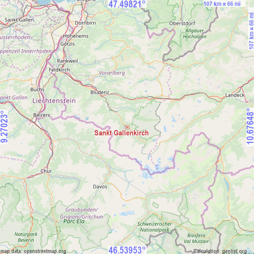
Sankt Gallenkirch GPS coordinates[2]
47° 1' 15.672" North, 9° 58' 24.06" East
| Map corner | latitude | longitude |
|---|---|---|
| Upper-left | 47.49821°, | 9.27023° |
| Center: | 47.02102°, | 9.97335° |
| Lower-right: | 46.53953°, | 10.67648° |
| Map W x H: | 106.6×106.6 km | = 66.2×66.2mi |
| max Lat: | 48.98333° ⇑83.2% North |
| Sankt Gallenkirch: | 47.02102° |
| min Lat: | ⇓16.8% South 46.48841° |
| min Long | Sankt Gallenkir | max Long |
| 9.57802° | 9.97335° | 17.1° |
| W 2.9%⇐ | ⇒97.1% E |
Elevation
Elevation of Sankt Gallenkirch is 879 m = 2884 ft, and this is 373.5 m = 1225 ft above average elevation for this country.
| Max E: |
2140 m = 7021 ft | 10.2% |
| Sankt Gallenkirch | 879 m 2884 ft | |
| Avg. | 505.5 m = 1658 ft | |
Min E: |
118 m = 387 ft | 89.8% |
See also: Austria elevation on elevation.city.
Geographical zone
Sankt Gallenkirch is located in North temperate zone (between Tropic of Cancer and the Arctic Circle). Distance of this North polar circle is 2172.9 km =1350.2 mi to North.| Distance of | km | miles | from Sankt Gallenkirch |
|---|---|---|---|
| North Pole | 4778.8 | 2969.4 | to North |
| Arctic Circle | 2172.9 | 1350.2 | to North |
| Tropic Cancer | 2622.3 | 1629.4 | to South |
| Equator | 5228.2 | 3248.7 | to South |


Nearby cities:
15 places around Sankt Gallenkirch: (largest is in red/bold)
• Ausserbraz
15.2 km =9.4 mi,  338°
338°
• Bartholomäberg
8.9 km =5.5 mi,  321°
321°
• Dalaas
11.6 km =7.2 mi,  6°
6°
• Gaschurn
5.6 km =3.5 mi,  133°
133°
• Gortipohl
2.2 km =1.4 mi,  120°
120°
• Innerbraz
15 km =9.3 mi, 343°
• Klösterle
15 km =9.3 mi,  33°
33°
• Lorüns
15.6 km =9.7 mi, 323°
• Sankt Anton im Montafon
13.4 km =8.3 mi, 322°
• Schruns
6.6 km =4.1 mi, 319°
• Silbertal
8.1 km =5 mi, 5°
• Stallehr
15.6 km =9.7 mi, 323°
• Tschagguns
8.9 km =5.5 mi, 321°
• Vandans
11.7 km =7.3 mi, 315°
• Wald am Arlberg
13.3 km =8.3 mi,  19°
19°
Sources, notices
• [Note1] Compared only with cities in Austria existing in our database
• [Src1] Map data: © OpenStreetMap contributors (CC-BY-SA)
• [Src2] Other city data from geonames.org with taken over terms of usage.
• [Src3] Geographical zone / Annual Mean Temperature by Robert A. Rohde @ Wikipedia
