Röthelstein geodata
Röthelstein (Styria) is a seat of a third-order administrative division; located in Austria in Europe/Vienna (GMT+2) time zone. With population of 201 people, there are 2849 cities with bigger population in this country. Compared to other cities in Austria, 64.5% of cities are located further ↑North; 61.9% of cities are located further ←West and 69.9% of cities have lower elevation than Röthelstein. Note1
Administrative division(s):
- Level 1: Styria
- Level 2: Politischer Bezirk Graz-Umgebung
- Level 3: Frohnleiten


Röthelstein GPS coordinates[2]
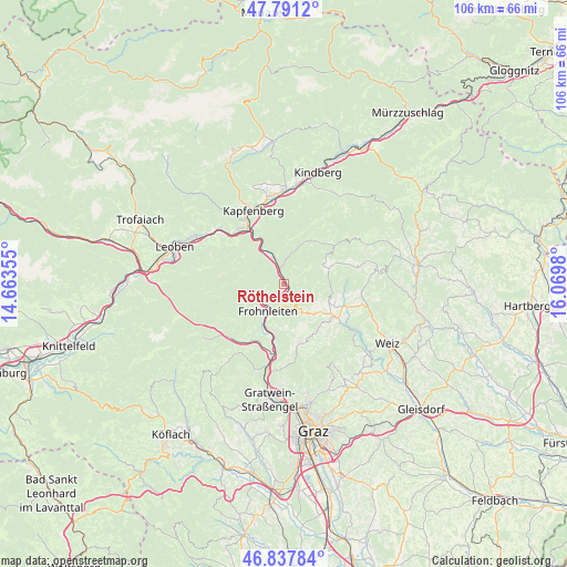
47° 19' 0.012" North, 15° 22' 0.012" East
| Map corner | latitude | longitude |
|---|---|---|
| Upper-left | 47.7912°, | 14.66355° |
| Center: | 47.31667°, | 15.36667° |
| Lower-right: | 46.83784°, | 16.0698° |
| Map W x H: | 106×106 km | = 65.9×65.9mi |
| max Lat: | 48.98333° ⇑64.5% North |
| Röthelstein: | 47.31667° |
| min Lat: | ⇓35.5% South 46.48841° |
| min Long | Röthelstein | max Long |
| 9.57802° | 15.36667° | 17.1° |
| W 61.9%⇐ | ⇒38.1% E |
Elevation
Elevation of Röthelstein is 588 m = 1929 ft, and this is 82.5 m = 271 ft above average elevation for this country.
| Max E: |
2140 m = 7021 ft | 30.1% |
| Röthelstein | 588 m 1929 ft | |
| Avg. | 505.5 m = 1658 ft | |
Min E: |
118 m = 387 ft | 69.9% |
See also: Austria elevation on elevation.city.
Geographical zone
Röthelstein is located in North temperate zone (between Tropic of Cancer and the Arctic Circle). Distance of this North polar circle is 2140.1 km =1329.8 mi to North.| Distance of | km | miles | from Röthelstein |
|---|---|---|---|
| North Pole | 4745.9 | 2949 | to North |
| Arctic Circle | 2140.1 | 1329.8 | to North |
| Tropic Cancer | 2655.2 | 1649.9 | to South |
| Equator | 5261.1 | 3269.1 | to South |


Nearby cities:
15 places around Röthelstein: (largest is in red/bold)
• Berndorf
13.4 km =8.3 mi,  325°
325°
• Bruck an der Mur
12.8 km =8 mi, 330°
• Deutschfeistritz
13.3 km =8.3 mi,  189°
189°
• Fladnitz an der Teichalm
9.1 km =5.7 mi,  112°
112°
• Frauenberg
12.6 km =7.8 mi,  351°
351°
• Frohnleiten
6.7 km =4.2 mi,  214°
214°
• Kirchdorf
5.3 km =3.3 mi,  314°
314°
• Land-Übelbach
13.4 km =8.3 mi,  217°
217°
• Passail
11.9 km =7.4 mi, 108°
• Peggau
13 km =8.1 mi, 185°
• Pernegg an der Mur
5.1 km =3.2 mi,  339°
339°
• Sankt Erhard
9.7 km =6 mi,  40°
40°
• Sankt Jakob-Breitenau
9.7 km =6 mi,  29°
29°
• Schrems bei Frohnleiten
4 km =2.5 mi, 187°
• Semriach
11.4 km =7.1 mi,  167°
167°
Sources, notices
• [Note1] Compared only with cities in Austria existing in our database
• [Src1] Map data: © OpenStreetMap contributors (CC-BY-SA)
• [Src2] Other city data from geonames.org with taken over terms of usage.
• [Src3] Geographical zone / Annual Mean Temperature by Robert A. Rohde @ Wikipedia
