Sankt Jakob-Breitenau geodata
Sankt Jakob-Breitenau (Styria) is a populated place; located in Austria in Europe/Vienna (GMT+2) time zone. With population of 1,127 people, there are 1130 cities with bigger population in this country. Compared to other cities in Austria, 60.1% of cities are located further ↑North; 63.5% of cities are located further ←West and 72.2% of cities have lower elevation than Sankt Jakob-Breitenau. Note1
Administrative division(s):
- Level 1: Styria
- Level 2: Politischer Bezirk Bruck-Mürzzuschlag
- Level 3: Breitenau am Hochlantsch


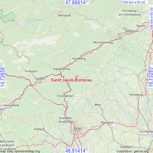
Sankt Jakob-Breitenau GPS coordinates[2]
47° 23' 32.244" North, 15° 25' 46.92" East
| Map corner | latitude | longitude |
|---|---|---|
| Upper-left | 47.86614°, | 14.72658° |
| Center: | 47.39229°, | 15.4297° |
| Lower-right: | 46.91414°, | 16.13283° |
| Map W x H: | 105.9×105.9 km | = 65.8×65.8mi |
| max Lat: | 48.98333° ⇑60.1% North |
| Sankt Jakob-Breitenau: | 47.39229° |
| min Lat: | ⇓39.9% South 46.48841° |
| min Long | Sankt Jakob-Bre | max Long |
| 9.57802° | 15.4297° | 17.1° |
| W 63.5%⇐ | ⇒36.5% E |
Elevation
Elevation of Sankt Jakob-Breitenau is 614 m = 2014 ft, and this is 108.5 m = 356 ft above average elevation for this country.
| Max E: |
2140 m = 7021 ft | 27.8% |
| Sankt Jakob-Breitenau | 614 m 2014 ft | |
| Avg. | 505.5 m = 1658 ft | |
Min E: |
118 m = 387 ft | 72.2% |
See also: Austria elevation on elevation.city.
Geographical zone
Sankt Jakob-Breitenau is located in North temperate zone (between Tropic of Cancer and the Arctic Circle). Distance of this North polar circle is 2131.6 km =1324.5 mi to North.| Distance of | km | miles | from Sankt Jakob-Breitenau |
|---|---|---|---|
| North Pole | 4737.5 | 2943.7 | to North |
| Arctic Circle | 2131.6 | 1324.5 | to North |
| Tropic Cancer | 2663.6 | 1655.1 | to South |
| Equator | 5269.5 | 3274.3 | to South |


Nearby cities:
15 places around Sankt Jakob-Breitenau: (largest is in red/bold)
• Allerheiligen im Mürztal
8.6 km =5.3 mi,  344°
344°
• Bruck an der Mur
11.3 km =7 mi,  283°
283°
• Deuchendorf
11.5 km =7.1 mi,  315°
315°
• Frauenberg
7.7 km =4.8 mi,  301°
301°
• Gasen
10.4 km =6.5 mi,  95°
95°
• Gassing
11.1 km =6.9 mi, 324°
• Hafendorf
11 km =6.8 mi,  310°
310°
• Kirchdorf
9.7 km =6 mi,  241°
241°
• Mürzhofen
10.7 km =6.6 mi, 340°
• Pernegg an der Mur
7.5 km =4.7 mi, 241°
• Röthelstein
9.7 km =6 mi,  209°
209°
• Sankt Erhard
1.8 km =1.1 mi,  123°
123°
• Sankt Lorenzen im Mürztal
11.2 km =7 mi,  334°
334°
• Sankt Marein im Mürztal
9.5 km =5.9 mi, 330°
• Schaldorf
9.5 km =5.9 mi, 333°
Sources, notices
• [Note1] Compared only with cities in Austria existing in our database
• [Src1] Map data: © OpenStreetMap contributors (CC-BY-SA)
• [Src2] Other city data from geonames.org with taken over terms of usage.
• [Src3] Geographical zone / Annual Mean Temperature by Robert A. Rohde @ Wikipedia
