Rannersdorf geodata
Rannersdorf (Lower Austria) is a populated place; located in Austria in Europe/Vienna (GMT+2) time zone. With population of 3,144 people, there are 355 cities with bigger population in this country. Compared to other cities in Austria, 74.2% of cities are located further ↓South; 92.9% of cities are located further ←West and 96.6% of cities have higher elevation than Rannersdorf. Note1
Administrative division(s):
- Level 1: Lower Austria
- Level 2: Politischer Bezirk Bruck an der Leitha
- Level 3: Schwechat


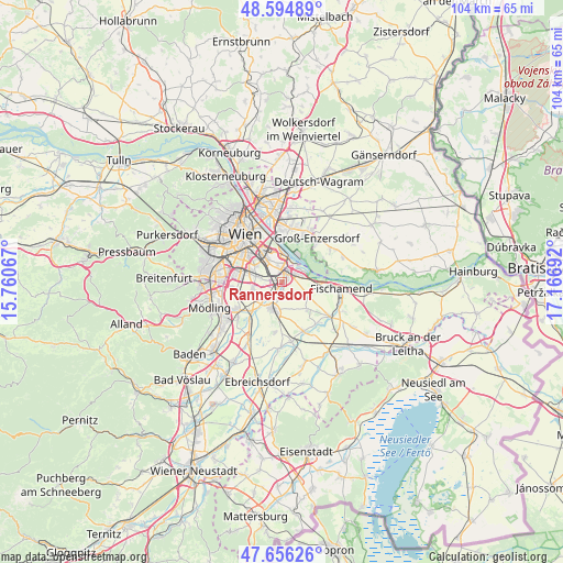
Rannersdorf GPS coordinates[2]
48° 7' 39.792" North, 16° 27' 49.644" East
| Map corner | latitude | longitude |
|---|---|---|
| Upper-left | 48.59489°, | 15.76067° |
| Center: | 48.12772°, | 16.46379° |
| Lower-right: | 47.65626°, | 17.16692° |
| Map W x H: | 104.4×104.4 km | = 64.9×64.9mi |
| max Lat: | 48.98333° ⇑25.8% North |
| Rannersdorf: | 48.12772° |
| min Lat: | ⇓74.2% South 46.48841° |
| min Long | Rannersdorf | max Long |
| 9.57802° | 16.46379° | 17.1° |
| W 92.9%⇐ | ⇒7.1% E |
Elevation
Elevation of Rannersdorf is 167 m = 548 ft, and this is 338.5 m = 1111 ft below average elevation for this country.
| Max E: |
2140 m = 7021 ft | 96.6% |
| Avg. | 505.5 m = 1658 ft | |
| Rannersdorf | 167 m = 548 ft | |
Min E: |
118 m = 387 ft | 3.4% |
See also: Austria elevation on elevation.city.
Geographical zone
Rannersdorf is located in North temperate zone (between Tropic of Cancer and the Arctic Circle). Distance of this North polar circle is 2049.9 km =1273.7 mi to North.| Distance of | km | miles | from Rannersdorf |
|---|---|---|---|
| North Pole | 4655.8 | 2893 | to North |
| Arctic Circle | 2049.9 | 1273.7 | to North |
| Tropic Cancer | 2745.4 | 1705.9 | to South |
| Equator | 5351.3 | 3325.1 | to South |


Nearby cities:
15 places around Rannersdorf: (largest is in red/bold)
• Achau
7.8 km =4.8 mi,  227°
227°
• Favoriten
7.1 km =4.4 mi,  301°
301°
• Hennersdorf
7.7 km =4.8 mi,  256°
256°
• Himberg
5.4 km =3.4 mi,  204°
204°
• Kledering
2.1 km =1.3 mi,  286°
286°
• Lanzendorf
2.4 km =1.5 mi,  216°
216°
• Leopoldsdorf
5.6 km =3.5 mi, 255°
• Mannswörth
4.2 km =2.6 mi,  61°
61°
• Maria Lanzendorf
4.5 km =2.8 mi, 225°
• Pellendorf
3.4 km =2.1 mi,  193°
193°
• Rauchenwarth
6.9 km =4.3 mi,  136°
136°
• Schwechat
0.7 km =0.4 mi,  18°
18°
• Simmering
6.6 km =4.1 mi,  339°
339°
• Vösendorf
9.2 km =5.7 mi,  265°
265°
• Zwölfaxing
2 km =1.2 mi,  182°
182°
Sources, notices
• [Note1] Compared only with cities in Austria existing in our database
• [Src1] Map data: © OpenStreetMap contributors (CC-BY-SA)
• [Src2] Other city data from geonames.org with taken over terms of usage.
• [Src3] Geographical zone / Annual Mean Temperature by Robert A. Rohde @ Wikipedia
