Mannswörth geodata
Mannswörth (Lower Austria) is a populated place; located in Austria in Europe/Vienna (GMT+2) time zone. With population of 1,948 people, there are 629 cities with bigger population in this country. Compared to other cities in Austria, 75.3% of cities are located further ↓South; 94.2% of cities are located further ←West and 97.8% of cities have higher elevation than Mannswörth. Note1
Administrative division(s):
- Level 1: Lower Austria
- Level 2: Politischer Bezirk Bruck an der Leitha
- Level 3: Schwechat


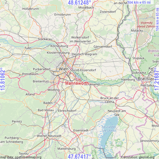
Mannswörth GPS coordinates[2]
48° 8' 43.692" North, 16° 30' 49.464" East
| Map corner | latitude | longitude |
|---|---|---|
| Upper-left | 48.61248°, | 15.81062° |
| Center: | 48.14547°, | 16.51374° |
| Lower-right: | 47.67417°, | 17.21687° |
| Map W x H: | 104.3×104.3 km | = 64.8×64.8mi |
| max Lat: | 48.98333° ⇑24.7% North |
| Mannswörth: | 48.14547° |
| min Lat: | ⇓75.3% South 46.48841° |
| min Long | Mannswörth | max Long |
| 9.57802° | 16.51374° | 17.1° |
| W 94.2%⇐ | ⇒5.8% E |
Elevation
Elevation of Mannswörth is 155 m = 509 ft, and this is 350.5 m = 1150 ft below average elevation for this country.
| Max E: |
2140 m = 7021 ft | 97.8% |
| Avg. | 505.5 m = 1658 ft | |
| Mannswörth | 155 m = 509 ft | |
Min E: |
118 m = 387 ft | 2.2% |
See also: Austria elevation on elevation.city.
Geographical zone
Mannswörth is located in North temperate zone (between Tropic of Cancer and the Arctic Circle). Distance of this North polar circle is 2047.9 km =1272.5 mi to North.| Distance of | km | miles | from Mannswörth |
|---|---|---|---|
| North Pole | 4653.8 | 2891.7 | to North |
| Arctic Circle | 2047.9 | 1272.5 | to North |
| Tropic Cancer | 2747.4 | 1707.2 | to South |
| Equator | 5353.3 | 3326.4 | to South |


Nearby cities:
15 places around Mannswörth: (largest is in red/bold)
• Fischamend Dorf
7.1 km =4.4 mi,  112°
112°
• Fischamend-Markt
7.2 km =4.5 mi,  116°
116°
• Groß-Enzersdorf
6.9 km =4.3 mi,  23°
23°
• Kledering
5.9 km =3.7 mi,  256°
256°
• Lanzendorf
6.4 km =4 mi,  232°
232°
• Maria Lanzendorf
8.7 km =5.4 mi, 233°
• Oberhausen
6.3 km =3.9 mi,  56°
56°
• Pellendorf
6.9 km =4.3 mi,  220°
220°
• Probstdorf
8.1 km =5 mi,  69°
69°
• Rannersdorf
4.2 km =2.6 mi,  241°
241°
• Rauchenwarth
7 km =4.3 mi,  171°
171°
• Schwechat
3.7 km =2.3 mi,  248°
248°
• Simmering
7.3 km =4.5 mi,  305°
305°
• Wittau
7.4 km =4.6 mi, 56°
• Zwölfaxing
5.5 km =3.4 mi, 223°
Sources, notices
• [Note1] Compared only with cities in Austria existing in our database
• [Src1] Map data: © OpenStreetMap contributors (CC-BY-SA)
• [Src2] Other city data from geonames.org with taken over terms of usage.
• [Src3] Geographical zone / Annual Mean Temperature by Robert A. Rohde @ Wikipedia
