Pruggern geodata
Pruggern (Styria) is a seat of a third-order administrative division; located in Austria in Europe/Vienna (GMT+2) time zone. With population of 754 people, there are 1718 cities with bigger population in this country. Compared to other cities in Austria, 58% of cities are located further ↑North; 67.3% of cities are located further →East and 78% of cities have lower elevation than Pruggern. Note1
Administrative division(s):
- Level 1: Styria
- Level 2: Politischer Bezirk Liezen
- Level 3: Michaelerberg-Pruggern


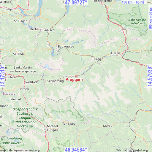
Pruggern GPS coordinates[2]
47° 25' 25.32" North, 13° 52' 34.5" East
| Map corner | latitude | longitude |
|---|---|---|
| Upper-left | 47.89727°, | 13.17313° |
| Center: | 47.4237°, | 13.87625° |
| Lower-right: | 46.94584°, | 14.57938° |
| Map W x H: | 105.8×105.8 km | = 65.7×65.7mi |
| max Lat: | 48.98333° ⇑58% North |
| Pruggern: | 47.4237° |
| min Lat: | ⇓42% South 46.48841° |
| min Long | Pruggern | max Long |
| 9.57802° | 13.87625° | 17.1° |
| W 32.7%⇐ | ⇒67.3% E |
Elevation
Elevation of Pruggern is 687 m = 2254 ft, and this is 181.5 m = 595 ft above average elevation for this country.
| Max E: |
2140 m = 7021 ft | 22% |
| Pruggern | 687 m 2254 ft | |
| Avg. | 505.5 m = 1658 ft | |
Min E: |
118 m = 387 ft | 78% |
See also: Austria elevation on elevation.city.
Geographical zone
Pruggern is located in North temperate zone (between Tropic of Cancer and the Arctic Circle). Distance of this North polar circle is 2128.2 km =1322.4 mi to North.| Distance of | km | miles | from Pruggern |
|---|---|---|---|
| North Pole | 4734 | 2941.6 | to North |
| Arctic Circle | 2128.2 | 1322.4 | to North |
| Tropic Cancer | 2667.1 | 1657.3 | to South |
| Equator | 5273 | 3276.5 | to South |


Nearby cities:
15 places around Pruggern: (largest is in red/bold)
• Aich
4.1 km =2.5 mi,  268°
268°
• Großsölk
6.8 km =4.2 mi,  96°
96°
• Gröbming
2.8 km =1.7 mi,  41°
41°
• Gössenberg
4.6 km =2.9 mi,  260°
260°
• Haus
8.3 km =5.2 mi, 259°
• Haus im Ennstal
8.3 km =5.2 mi, 259°
• Kleinsölk
5.8 km =3.6 mi,  124°
124°
• Michaelerberg
1.9 km =1.2 mi,  138°
138°
• Mitterberg
7 km =4.3 mi,  52°
52°
• Neuhofen
14.7 km =9.1 mi,  16°
16°
• Niederöblarn
12.3 km =7.6 mi,  61°
61°
• Sankt Martin am Grimming
10.7 km =6.6 mi, 47°
• Schladming
14.6 km =9.1 mi, 256°
• Weißenbach
7.3 km =4.5 mi, 269°
• Öblarn
9.4 km =5.8 mi,  65°
65°
Sources, notices
• [Note1] Compared only with cities in Austria existing in our database
• [Src1] Map data: © OpenStreetMap contributors (CC-BY-SA)
• [Src2] Other city data from geonames.org with taken over terms of usage.
• [Src3] Geographical zone / Annual Mean Temperature by Robert A. Rohde @ Wikipedia
