Weißenbach geodata
Weißenbach (Styria) is a populated place; located in Austria in Europe/Vienna (GMT+2) time zone. With population of 592 people, there are 2162 cities with bigger population in this country. Compared to other cities in Austria, 58% of cities are located further ↑North; 69.6% of cities are located further →East and 80.3% of cities have lower elevation than Weißenbach. Note1


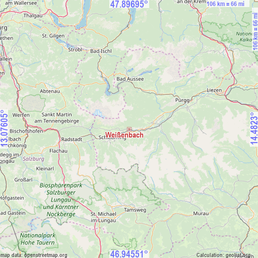
Weißenbach GPS coordinates[2]
47° 25' 24.168" North, 13° 46' 45.012" East
| Map corner | latitude | longitude |
|---|---|---|
| Upper-left | 47.89695°, | 13.07605° |
| Center: | 47.42338°, | 13.77917° |
| Lower-right: | 46.94551°, | 14.4823° |
| Map W x H: | 105.8×105.8 km | = 65.7×65.7mi |
| max Lat: | 48.98333° ⇑58% North |
| Weißenbach: | 47.42338° |
| min Lat: | ⇓42% South 46.48841° |
| min Long | Weißenbach | max Long |
| 9.57802° | 13.77917° | 17.1° |
| W 30.4%⇐ | ⇒69.6% E |
Elevation
Elevation of Weißenbach is 725 m = 2379 ft, and this is 219.5 m = 720 ft above average elevation for this country.
| Max E: |
2140 m = 7021 ft | 19.7% |
| Weißenbach | 725 m 2379 ft | |
| Avg. | 505.5 m = 1658 ft | |
Min E: |
118 m = 387 ft | 80.3% |
See also: Austria elevation on elevation.city.
Geographical zone
Weißenbach is located in North temperate zone (between Tropic of Cancer and the Arctic Circle). Distance of this North polar circle is 2128.2 km =1322.4 mi to North.| Distance of | km | miles | from Weißenbach |
|---|---|---|---|
| North Pole | 4734.1 | 2941.6 | to North |
| Arctic Circle | 2128.2 | 1322.4 | to North |
| Tropic Cancer | 2667.1 | 1657.3 | to South |
| Equator | 5273 | 3276.5 | to South |


Nearby cities:
15 places around Weißenbach: (largest is in red/bold)
• Aich
3.2 km =2 mi,  91°
91°
• Großsölk
14.1 km =8.8 mi, 93°
• Gröbming
9.4 km =5.8 mi,  76°
76°
• Gössenberg
2.9 km =1.8 mi,  104°
104°
• Haus
1.7 km =1.1 mi,  211°
211°
• Haus im Ennstal
1.7 km =1.1 mi, 211°
• Kleinsölk
12.5 km =7.8 mi, 104°
• Michaelerberg
8.7 km =5.4 mi, 99°
• Mitterberg
13.5 km =8.4 mi,  71°
71°
• Obere Klaus
10.3 km =6.4 mi,  250°
250°
• Pichl
14.2 km =8.8 mi, 251°
• Pruggern
7.3 km =4.5 mi, 89°
• Ramsau am Dachstein
9.3 km =5.8 mi,  268°
268°
• Rohrmoos
9.3 km =5.8 mi,  241°
241°
• Schladming
7.7 km =4.8 mi, 243°
Sources, notices
• [Note1] Compared only with cities in Austria existing in our database
• [Src1] Map data: © OpenStreetMap contributors (CC-BY-SA)
• [Src2] Other city data from geonames.org with taken over terms of usage.
• [Src3] Geographical zone / Annual Mean Temperature by Robert A. Rohde @ Wikipedia
