Öblarn geodata
Öblarn (Styria) is a seat of a third-order administrative division; located in Austria in Europe/Vienna (GMT+2) time zone. With population of 1,059 people, there are 1207 cities with bigger population in this country. Compared to other cities in Austria, 56% of cities are located further ↑North; 65.2% of cities are located further →East and 76.5% of cities have lower elevation than Öblarn. Note1


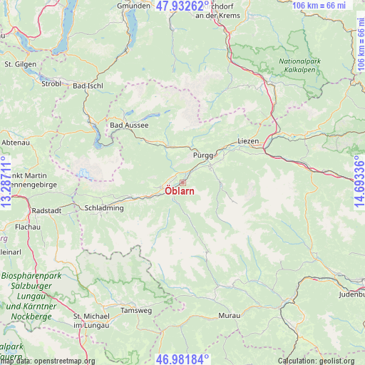
Öblarn GPS coordinates[2]
47° 27' 33.768" North, 13° 59' 24.828" East
| Map corner | latitude | longitude |
|---|---|---|
| Upper-left | 47.93262°, | 13.28711° |
| Center: | 47.45938°, | 13.99023° |
| Lower-right: | 46.98184°, | 14.69336° |
| Map W x H: | 105.7×105.7 km | = 65.7×65.7mi |
| max Lat: | 48.98333° ⇑56% North |
| Öblarn: | 47.45938° |
| min Lat: | ⇓44% South 46.48841° |
| min Long | Öblarn | max Long |
| 9.57802° | 13.99023° | 17.1° |
| W 34.8%⇐ | ⇒65.2% E |
Elevation
Elevation of Öblarn is 668 m = 2192 ft, and this is 162.5 m = 533 ft above average elevation for this country.
| Max E: |
2140 m = 7021 ft | 23.5% |
| Öblarn | 668 m 2192 ft | |
| Avg. | 505.5 m = 1658 ft | |
Min E: |
118 m = 387 ft | 76.5% |
See also: Austria elevation on elevation.city.
Geographical zone
Öblarn is located in North temperate zone (between Tropic of Cancer and the Arctic Circle). Distance of this North polar circle is 2124.2 km =1319.9 mi to North.| Distance of | km | miles | from Öblarn |
|---|---|---|---|
| North Pole | 4730.1 | 2939.1 | to North |
| Arctic Circle | 2124.2 | 1319.9 | to North |
| Tropic Cancer | 2671.1 | 1659.7 | to South |
| Equator | 5277 | 3279 | to South |


Nearby cities:
15 places around Öblarn: (largest is in red/bold)
• Donnersbach
10.5 km =6.5 mi,  88°
88°
• Falkenburg
8.3 km =5.2 mi,  57°
57°
• Großsölk
5.1 km =3.2 mi,  200°
200°
• Gröbming
6.9 km =4.3 mi,  254°
254°
• Irdning
9.8 km =6.1 mi, 58°
• Kleinsölk
8.2 km =5.1 mi,  207°
207°
• Michaelerberg
9.1 km =5.7 mi,  233°
233°
• Mitterberg
3 km =1.9 mi,  275°
275°
• Mitterndorf im Steirischen Salzkammergut
11.6 km =7.2 mi,  337°
337°
• Neuhofen
10.9 km =6.8 mi, 337°
• Niederöblarn
2.9 km =1.8 mi,  48°
48°
• Pruggern
9.4 km =5.8 mi, 245°
• Sankt Martin am Grimming
3.3 km =2.1 mi,  348°
348°
• Stainach
12.1 km =7.5 mi, 47°
• Tauplitz
11.3 km =7 mi,  8°
8°
Sources, notices
• [Note1] Compared only with cities in Austria existing in our database
• [Src1] Map data: © OpenStreetMap contributors (CC-BY-SA)
• [Src2] Other city data from geonames.org with taken over terms of usage.
• [Src3] Geographical zone / Annual Mean Temperature by Robert A. Rohde @ Wikipedia
