Obersdorf geodata
Obersdorf (Lower Austria) is a populated place; located in Austria in Europe/Vienna (GMT+2) time zone. With population of 1,702 people, there are 735 cities with bigger population in this country. Compared to other cities in Austria, 89.3% of cities are located further ↓South; 94.2% of cities are located further ←West and 96.6% of cities have higher elevation than Obersdorf. Note1
Administrative division(s):
- Level 1: Lower Austria
- Level 2: Politischer Bezirk Mistelbach
- Level 3: Wolkersdorf im Weinviertel


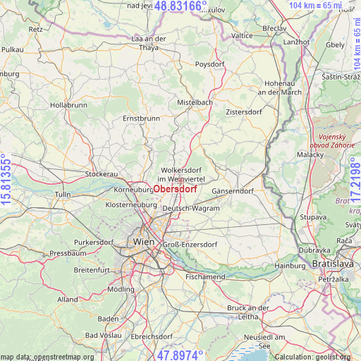
Obersdorf GPS coordinates[2]
48° 22' 0.012" North, 16° 31' 0.012" East
| Map corner | latitude | longitude |
|---|---|---|
| Upper-left | 48.83166°, | 15.81355° |
| Center: | 48.36667°, | 16.51667° |
| Lower-right: | 47.8974°, | 17.2198° |
| Map W x H: | 103.9×103.9 km | = 64.6×64.6mi |
| max Lat: | 48.98333° ⇑10.7% North |
| Obersdorf: | 48.36667° |
| min Lat: | ⇓89.3% South 46.48841° |
| min Long | Obersdorf | max Long |
| 9.57802° | 16.51667° | 17.1° |
| W 94.2%⇐ | ⇒5.8% E |
Elevation
Elevation of Obersdorf is 167 m = 548 ft, and this is 338.5 m = 1111 ft below average elevation for this country.
| Max E: |
2140 m = 7021 ft | 96.6% |
| Avg. | 505.5 m = 1658 ft | |
| Obersdorf | 167 m = 548 ft | |
Min E: |
118 m = 387 ft | 3.4% |
See also: Austria elevation on elevation.city.
Geographical zone
Obersdorf is located in North temperate zone (between Tropic of Cancer and the Arctic Circle). Distance of this North polar circle is 2023.3 km =1257.2 mi to North.| Distance of | km | miles | from Obersdorf |
|---|---|---|---|
| North Pole | 4629.2 | 2876.5 | to North |
| Arctic Circle | 2023.3 | 1257.2 | to North |
| Tropic Cancer | 2772 | 1722.4 | to South |
| Equator | 5377.9 | 3341.7 | to South |


Nearby cities:
15 places around Obersdorf: (largest is in red/bold)
• Auersthal
8.8 km =5.5 mi,  84°
84°
• Bockfließ
6.5 km =4 mi,  96°
96°
• Deutsch-Wagram
8.3 km =5.2 mi,  153°
153°
• Enzersfeld
6.9 km =4.3 mi,  266°
266°
• Groß-Engersdorf
3.8 km =2.4 mi, 103°
• Großebersdorf
3.4 km =2.1 mi, 265°
• Hautzendorf
7.8 km =4.8 mi,  341°
341°
• Königsbrunn im Weinviertel
8.2 km =5.1 mi,  255°
255°
• Münichsthal
4.1 km =2.5 mi,  296°
296°
• Pillichsdorf
2.2 km =1.4 mi, 146°
• Schleinbach
6.7 km =4.2 mi,  326°
326°
• Seyring
4.5 km =2.8 mi,  213°
213°
• Ulrichskirchen
4.4 km =2.7 mi, 326°
• Unterolberndorf
7.8 km =4.8 mi, 341°
• Wolkersdorf im Weinviertel
1.9 km =1.2 mi,  0°
0°
Sources, notices
• [Note1] Compared only with cities in Austria existing in our database
• [Src1] Map data: © OpenStreetMap contributors (CC-BY-SA)
• [Src2] Other city data from geonames.org with taken over terms of usage.
• [Src3] Geographical zone / Annual Mean Temperature by Robert A. Rohde @ Wikipedia
