Auersthal geodata
Auersthal (Lower Austria) is a seat of a third-order administrative division; located in Austria in Europe/Vienna (GMT+2) time zone. With population of 1,932 people, there are 641 cities with bigger population in this country. Compared to other cities in Austria, 89.6% of cities are located further ↓South; 96.5% of cities are located further ←West and 94.7% of cities have higher elevation than Auersthal. Note1
Administrative division(s):
- Level 1: Lower Austria
- Level 2: Politischer Bezirk Gänserndorf
- Level 3: Auersthal


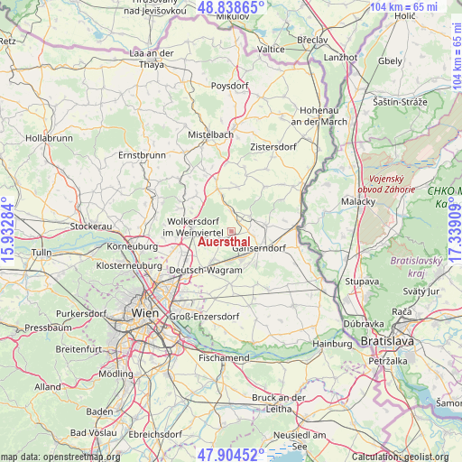
Auersthal GPS coordinates[2]
48° 22' 25.428" North, 16° 38' 9.456" East
| Map corner | latitude | longitude |
|---|---|---|
| Upper-left | 48.83865°, | 15.93284° |
| Center: | 48.37373°, | 16.63596° |
| Lower-right: | 47.90452°, | 17.33909° |
| Map W x H: | 103.9×103.9 km | = 64.6×64.6mi |
| max Lat: | 48.98333° ⇑10.4% North |
| Auersthal: | 48.37373° |
| min Lat: | ⇓89.6% South 46.48841° |
| min Long | Auersthal | max Long |
| 9.57802° | 16.63596° | 17.1° |
| W 96.5%⇐ | ⇒3.5% E |
Elevation
Elevation of Auersthal is 181 m = 594 ft, and this is 324.5 m = 1065 ft below average elevation for this country.
| Max E: |
2140 m = 7021 ft | 94.7% |
| Avg. | 505.5 m = 1658 ft | |
| Auersthal | 181 m = 594 ft | |
Min E: |
118 m = 387 ft | 5.3% |
See also: Austria elevation on elevation.city.
Geographical zone
Auersthal is located in North temperate zone (between Tropic of Cancer and the Arctic Circle). Distance of this North polar circle is 2022.5 km =1256.7 mi to North.| Distance of | km | miles | from Auersthal |
|---|---|---|---|
| North Pole | 4628.4 | 2876 | to North |
| Arctic Circle | 2022.5 | 1256.7 | to North |
| Tropic Cancer | 2772.7 | 1722.9 | to South |
| Equator | 5378.7 | 3342.2 | to South |


Nearby cities:
15 places around Auersthal: (largest is in red/bold)
• Bad Pirawarth
9.1 km =5.7 mi,  342°
342°
• Bockfließ
2.8 km =1.7 mi,  237°
237°
• Deutsch-Wagram
9.7 km =6 mi,  211°
211°
• Groß-Engersdorf
5.4 km =3.4 mi,  252°
252°
• Groß-Schweinbarth
4.6 km =2.9 mi,  356°
356°
• Gänserndorf
7.3 km =4.5 mi,  121°
121°
• Hohenruppersdorf
10.2 km =6.3 mi,  6°
6°
• Matzen
5.6 km =3.5 mi,  58°
58°
• Obersdorf
8.8 km =5.5 mi,  264°
264°
• Pillichsdorf
8 km =5 mi, 250°
• Prottes
7.7 km =4.8 mi,  79°
79°
• Raggendorf
2.8 km =1.7 mi,  35°
35°
• Schönkirchen-Reyersdorf
4.6 km =2.9 mi, 117°
• Strasshof an der Nordbahn
6.7 km =4.2 mi,  160°
160°
• Wolkersdorf im Weinviertel
8.9 km =5.5 mi,  276°
276°
Sources, notices
• [Note1] Compared only with cities in Austria existing in our database
• [Src1] Map data: © OpenStreetMap contributors (CC-BY-SA)
• [Src2] Other city data from geonames.org with taken over terms of usage.
• [Src3] Geographical zone / Annual Mean Temperature by Robert A. Rohde @ Wikipedia
