Unterolberndorf geodata
Unterolberndorf (Lower Austria) is a populated place; located in Austria in Europe/Vienna (GMT+2) time zone. With population of 656 people, there are 1966 cities with bigger population in this country. Compared to other cities in Austria, 91.9% of cities are located further ↓South; 93.4% of cities are located further ←West and 91% of cities have higher elevation than Unterolberndorf. Note1
Administrative division(s):
- Level 1: Lower Austria
- Level 2: Politischer Bezirk Mistelbach
- Level 3: Kreuttal


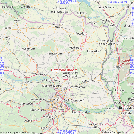
Unterolberndorf GPS coordinates[2]
48° 25' 59.988" North, 16° 28' 59.988" East
| Map corner | latitude | longitude |
|---|---|---|
| Upper-left | 48.89771°, | 15.78021° |
| Center: | 48.43333°, | 16.48333° |
| Lower-right: | 47.96467°, | 17.18646° |
| Map W x H: | 103.7×103.7 km | = 64.4×64.4mi |
| max Lat: | 48.98333° ⇑8.1% North |
| Unterolberndorf: | 48.43333° |
| min Lat: | ⇓91.9% South 46.48841° |
| min Long | Unterolberndorf | max Long |
| 9.57802° | 16.48333° | 17.1° |
| W 93.4%⇐ | ⇒6.6% E |
Elevation
Elevation of Unterolberndorf is 207 m = 679 ft, and this is 298.5 m = 979 ft below average elevation for this country.
| Max E: |
2140 m = 7021 ft | 91% |
| Avg. | 505.5 m = 1658 ft | |
| Unterolberndorf | 207 m = 679 ft | |
Min E: |
118 m = 387 ft | 9% |
See also: Austria elevation on elevation.city.
Geographical zone
Unterolberndorf is located in North temperate zone (between Tropic of Cancer and the Arctic Circle). Distance of this North polar circle is 2015.9 km =1252.6 mi to North.| Distance of | km | miles | from Unterolberndorf |
|---|---|---|---|
| North Pole | 4621.8 | 2871.9 | to North |
| Arctic Circle | 2015.9 | 1252.6 | to North |
| Tropic Cancer | 2779.4 | 1727 | to South |
| Equator | 5385.3 | 3346.3 | to South |


Nearby cities:
15 places around Unterolberndorf: (largest is in red/bold)
• Bad Pirawarth
8.7 km =5.4 mi,  76°
76°
• Großebersdorf
7.8 km =4.8 mi,  186°
186°
• Großrußbach
6.7 km =4.2 mi,  312°
312°
• Hautzendorf
0 km =0 mi,  0°
0°
• Hochleithen
4.1 km =2.5 mi,  57°
57°
• Kreuzstetten
5.3 km =3.3 mi,  351°
351°
• Münichsthal
5.7 km =3.5 mi, 192°
• Niederkreuzstetten
4.9 km =3 mi,  355°
355°
• Obergänserndorf
8.8 km =5.5 mi,  257°
257°
• Obersdorf
7.8 km =4.8 mi,  161°
161°
• Schleinbach
2.2 km =1.4 mi,  213°
213°
• Ulrichskirchen
3.7 km =2.3 mi,  180°
180°
• Wolfpassing an der Hochleithen
3.1 km =1.9 mi,  52°
52°
• Wolkersdorf im Weinviertel
6.1 km =3.8 mi, 156°
• Würnitz
5.3 km =3.3 mi,  249°
249°
Sources, notices
• [Note1] Compared only with cities in Austria existing in our database
• [Src1] Map data: © OpenStreetMap contributors (CC-BY-SA)
• [Src2] Other city data from geonames.org with taken over terms of usage.
• [Src3] Geographical zone / Annual Mean Temperature by Robert A. Rohde @ Wikipedia
