Niklasdorf geodata
Niklasdorf (Styria) is a seat of a third-order administrative division; located in Austria in Europe/Vienna (GMT+2) time zone. With population of 2,515 people, there are 474 cities with bigger population in this country. Compared to other cities in Austria, 60.9% of cities are located further ↑North; 56.8% of cities are located further ←West and 72.7% of cities have lower elevation than Niklasdorf. Note1


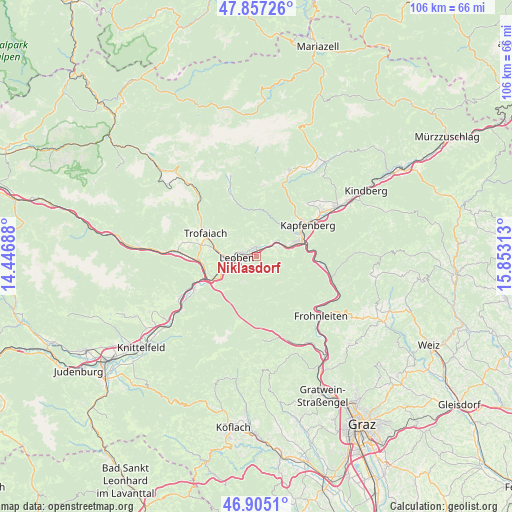
Niklasdorf GPS coordinates[2]
47° 22' 59.988" North, 15° 9' 0" East
| Map corner | latitude | longitude |
|---|---|---|
| Upper-left | 47.85726°, | 14.44688° |
| Center: | 47.38333°, | 15.15° |
| Lower-right: | 46.9051°, | 15.85313° |
| Map W x H: | 105.9×105.9 km | = 65.8×65.8mi |
| max Lat: | 48.98333° ⇑60.9% North |
| Niklasdorf: | 47.38333° |
| min Lat: | ⇓39.1% South 46.48841° |
| min Long | Niklasdorf | max Long |
| 9.57802° | 15.15° | 17.1° |
| W 56.8%⇐ | ⇒43.2% E |
Elevation
Elevation of Niklasdorf is 622 m = 2041 ft, and this is 116.5 m = 382 ft above average elevation for this country.
| Max E: |
2140 m = 7021 ft | 27.3% |
| Niklasdorf | 622 m 2041 ft | |
| Avg. | 505.5 m = 1658 ft | |
Min E: |
118 m = 387 ft | 72.7% |
See also: Austria elevation on elevation.city.
Geographical zone
Niklasdorf is located in North temperate zone (between Tropic of Cancer and the Arctic Circle). Distance of this North polar circle is 2132.6 km =1325.1 mi to North.| Distance of | km | miles | from Niklasdorf |
|---|---|---|---|
| North Pole | 4738.5 | 2944.4 | to North |
| Arctic Circle | 2132.6 | 1325.1 | to North |
| Tropic Cancer | 2662.6 | 1654.5 | to South |
| Equator | 5268.5 | 3273.7 | to South |


Nearby cities:
15 places around Niklasdorf: (largest is in red/bold)
• Berndorf
9.5 km =5.9 mi,  67°
67°
• Donawitz
6.5 km =4 mi,  253°
253°
• Göss
4.6 km =2.9 mi,  233°
233°
• Hessenberg
10.2 km =6.3 mi,  278°
278°
• Hinterberg
6.6 km =4.1 mi, 247°
• Judendorf
4.2 km =2.6 mi,  296°
296°
• Laintal
9.6 km =6 mi, 299°
• Leitendorf
5.4 km =3.4 mi, 249°
• Leoben
4.5 km =2.8 mi,  260°
260°
• Oberaich
5.3 km =3.3 mi, 69°
• Proleb
2.2 km =1.4 mi,  325°
325°
• Sankt Katharein an der Laming
9.8 km =6.1 mi,  5°
5°
• Sankt Peter-Freienstein
10 km =6.2 mi,  270°
270°
• Urgental
7.5 km =4.7 mi, 69°
• Utschtal
4.2 km =2.6 mi,  63°
63°
Sources, notices
• [Note1] Compared only with cities in Austria existing in our database
• [Src1] Map data: © OpenStreetMap contributors (CC-BY-SA)
• [Src2] Other city data from geonames.org with taken over terms of usage.
• [Src3] Geographical zone / Annual Mean Temperature by Robert A. Rohde @ Wikipedia
