Mönichwald geodata
Mönichwald (Styria) is a seat of a third-order administrative division; located in Austria in Europe/Vienna (GMT+2) time zone. In our database, there are 2958 cities with bigger population. Compared to other cities in Austria, 56.9% of cities are located further ↑North; 76.8% of cities are located further ←West and 68.4% of cities have lower elevation than Mönichwald. Note1
Administrative division(s):
- Level 1: Styria
- Level 2: Politischer Bezirk Hartberg-Fürstenfeld
- Level 3: Vorau


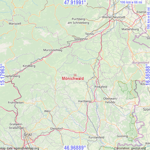
Mönichwald GPS coordinates[2]
47° 26' 47.58" North, 15° 52' 57.9" East
| Map corner | latitude | longitude |
|---|---|---|
| Upper-left | 47.91991°, | 15.17963° |
| Center: | 47.44655°, | 15.88275° |
| Lower-right: | 46.96889°, | 16.58588° |
| Map W x H: | 105.7×105.7 km | = 65.7×65.7mi |
| max Lat: | 48.98333° ⇑56.9% North |
| Mönichwald: | 47.44655° |
| min Lat: | ⇓43.1% South 46.48841° |
| min Long | Mönichwald | max Long |
| 9.57802° | 15.88275° | 17.1° |
| W 76.8%⇐ | ⇒23.2% E |
Elevation
Elevation of Mönichwald is 574 m = 1883 ft, and this is 68.5 m = 225 ft above average elevation for this country.
| Max E: |
2140 m = 7021 ft | 31.6% |
| Mönichwald | 574 m 1883 ft | |
| Avg. | 505.5 m = 1658 ft | |
Min E: |
118 m = 387 ft | 68.4% |
See also: Austria elevation on elevation.city.
Geographical zone
Mönichwald is located in North temperate zone (between Tropic of Cancer and the Arctic Circle). Distance of this North polar circle is 2125.6 km =1320.8 mi to North.| Distance of | km | miles | from Mönichwald |
|---|---|---|---|
| North Pole | 4731.5 | 2940 | to North |
| Arctic Circle | 2125.6 | 1320.8 | to North |
| Tropic Cancer | 2669.6 | 1658.8 | to South |
| Equator | 5275.6 | 3278.1 | to South |


Nearby cities:
15 places around Mönichwald: (largest is in red/bold)
• Dechantskirchen
10.6 km =6.6 mi,  108°
108°
• Eichberg
9.9 km =6.2 mi,  136°
136°
• Karnerviertel
2.6 km =1.6 mi,  18°
18°
• Kirchenviertel
7.4 km =4.6 mi,  289°
289°
• Pittermann
8.2 km =5.1 mi,  246°
246°
• Pongrazen bei Hartberg
11.8 km =7.3 mi,  170°
170°
• Puchegg
7.3 km =4.5 mi,  175°
175°
• Rabenwald
5.3 km =3.3 mi, 165°
• Riegersbach
3.6 km =2.2 mi,  158°
158°
• Rohrbach an der Lafnitz
11.3 km =7 mi,  128°
128°
• Sankt Jakob im Walde
7.8 km =4.8 mi, 286°
• Sankt Lorenzen am Wechsel
5.5 km =3.4 mi,  95°
95°
• Schachen bei Vorau
7.6 km =4.7 mi,  194°
194°
• Vorau
4.6 km =2.9 mi, 175°
• Vornholz
6.9 km =4.3 mi,  217°
217°
Sources, notices
• [Note1] Compared only with cities in Austria existing in our database
• [Src1] Map data: © OpenStreetMap contributors (CC-BY-SA)
• [Src2] Other city data from geonames.org with taken over terms of usage.
• [Src3] Geographical zone / Annual Mean Temperature by Robert A. Rohde @ Wikipedia
