Kirchenviertel geodata
Kirchenviertel (Styria) is a populated place; located in Austria in Europe/Vienna (GMT+2) time zone. With population of 554 people, there are 2301 cities with bigger population in this country. Compared to other cities in Austria, 55.4% of cities are located further ↑North; 74.5% of cities are located further ←West and 91.7% of cities have lower elevation than Kirchenviertel. Note1
Administrative division(s):
- Level 1: Styria
- Level 2: Politischer Bezirk Hartberg-Fürstenfeld
- Level 3: Sankt Jakob im Walde


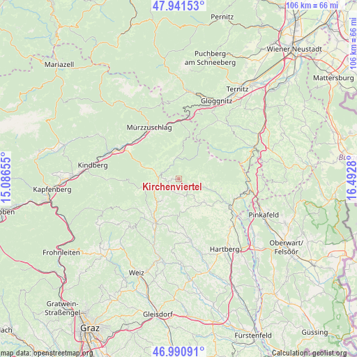
Kirchenviertel GPS coordinates[2]
47° 28' 6.132" North, 15° 47' 22.812" East
| Map corner | latitude | longitude |
|---|---|---|
| Upper-left | 47.94153°, | 15.08655° |
| Center: | 47.46837°, | 15.78967° |
| Lower-right: | 46.99091°, | 16.4928° |
| Map W x H: | 105.7×105.7 km | = 65.7×65.7mi |
| max Lat: | 48.98333° ⇑55.4% North |
| Kirchenviertel: | 47.46837° |
| min Lat: | ⇓44.6% South 46.48841° |
| min Long | Kirchenviertel | max Long |
| 9.57802° | 15.78967° | 17.1° |
| W 74.5%⇐ | ⇒25.5% E |
Elevation
Elevation of Kirchenviertel is 915 m = 3002 ft, and this is 409.5 m = 1344 ft above average elevation for this country.
| Max E: |
2140 m = 7021 ft | 8.3% |
| Kirchenviertel | 915 m 3002 ft | |
| Avg. | 505.5 m = 1658 ft | |
Min E: |
118 m = 387 ft | 91.7% |
See also: Austria elevation on elevation.city.
Geographical zone
Kirchenviertel is located in North temperate zone (between Tropic of Cancer and the Arctic Circle). Distance of this North polar circle is 2123.2 km =1319.3 mi to North.| Distance of | km | miles | from Kirchenviertel |
|---|---|---|---|
| North Pole | 4729.1 | 2938.5 | to North |
| Arctic Circle | 2123.2 | 1319.3 | to North |
| Tropic Cancer | 2672.1 | 1660.4 | to South |
| Equator | 5278 | 3279.6 | to South |


Nearby cities:
15 places around Kirchenviertel: (largest is in red/bold)
• Falkenstein
8.3 km =5.2 mi,  255°
255°
• Karnerviertel
7.8 km =4.8 mi,  89°
89°
• Kirchenviertel
5.5 km =3.4 mi,  290°
290°
• Klaffenegg
6 km =3.7 mi,  338°
338°
• Mönichwald
7.4 km =4.6 mi,  109°
109°
• Pittermann
5.8 km =3.6 mi,  184°
184°
• Ratten
5.7 km =3.5 mi, 286°
• Rettenegg
6.5 km =4 mi,  354°
354°
• Riegersbach
10.1 km =6.3 mi,  124°
124°
• Sankt Jakob im Walde
0.5 km =0.3 mi,  248°
248°
• Sankt Kathrein am Hauenstein
7.6 km =4.7 mi, 288°
• Sticklberg
6.9 km =4.3 mi, 353°
• Strallegg
7.9 km =4.9 mi,  217°
217°
• Vorau
10.2 km =6.3 mi,  133°
133°
• Vornholz
8.4 km =5.2 mi,  160°
160°
Sources, notices
• [Note1] Compared only with cities in Austria existing in our database
• [Src1] Map data: © OpenStreetMap contributors (CC-BY-SA)
• [Src2] Other city data from geonames.org with taken over terms of usage.
• [Src3] Geographical zone / Annual Mean Temperature by Robert A. Rohde @ Wikipedia
