Puchegg geodata
Puchegg (Styria) is a populated place; located in Austria in Europe/Vienna (GMT+2) time zone. With population of 546 people, there are 2336 cities with bigger population in this country. Compared to other cities in Austria, 61% of cities are located further ↑North; 77% of cities are located further ←West and 88.1% of cities have lower elevation than Puchegg. Note1
Administrative division(s):
- Level 1: Styria
- Level 2: Politischer Bezirk Hartberg-Fürstenfeld
- Level 3: Vorau


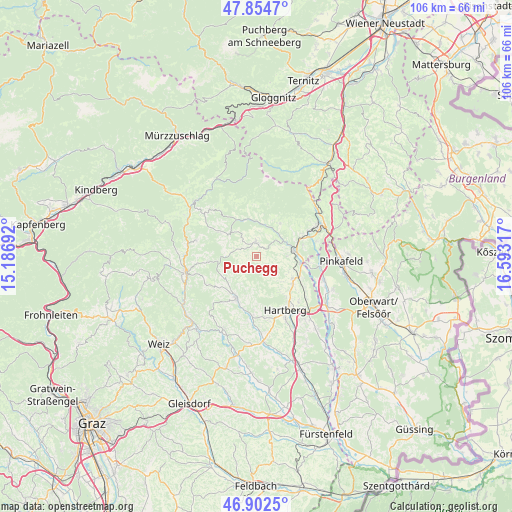
Puchegg GPS coordinates[2]
47° 22' 50.7" North, 15° 53' 24.144" East
| Map corner | latitude | longitude |
|---|---|---|
| Upper-left | 47.8547°, | 15.18692° |
| Center: | 47.38075°, | 15.89004° |
| Lower-right: | 46.9025°, | 16.59317° |
| Map W x H: | 105.9×105.9 km | = 65.8×65.8mi |
| max Lat: | 48.98333° ⇑61% North |
| Puchegg: | 47.38075° |
| min Lat: | ⇓39% South 46.48841° |
| min Long | Puchegg | max Long |
| 9.57802° | 15.89004° | 17.1° |
| W 77%⇐ | ⇒23% E |
Elevation
Elevation of Puchegg is 846 m = 2776 ft, and this is 340.5 m = 1117 ft above average elevation for this country.
| Max E: |
2140 m = 7021 ft | 11.9% |
| Puchegg | 846 m 2776 ft | |
| Avg. | 505.5 m = 1658 ft | |
Min E: |
118 m = 387 ft | 88.1% |
See also: Austria elevation on elevation.city.
Geographical zone
Puchegg is located in North temperate zone (between Tropic of Cancer and the Arctic Circle). Distance of this North polar circle is 2132.9 km =1325.3 mi to North.| Distance of | km | miles | from Puchegg |
|---|---|---|---|
| North Pole | 4738.8 | 2944.6 | to North |
| Arctic Circle | 2132.9 | 1325.3 | to North |
| Tropic Cancer | 2662.3 | 1654.3 | to South |
| Equator | 5268.2 | 3273.5 | to South |


Nearby cities:
15 places around Puchegg: (largest is in red/bold)
• Eichberg
6.3 km =3.9 mi,  88°
88°
• Mönichwald
7.3 km =4.5 mi,  355°
355°
• Oberneuberg
7.3 km =4.5 mi,  193°
193°
• Pongrazen bei Hartberg
4.6 km =2.9 mi,  160°
160°
• Prätis
7 km =4.3 mi,  236°
236°
• Pöllauberg
7.7 km =4.8 mi,  202°
202°
• Rabenwald
2.3 km =1.4 mi,  19°
19°
• Riegersbach
4.1 km =2.5 mi,  10°
10°
• Sankt Lorenzen am Wechsel
8.3 km =5.2 mi,  35°
35°
• Schachen bei Vorau
2.4 km =1.5 mi,  268°
268°
• Stambach
6.2 km =3.9 mi,  148°
148°
• Unterneuberg
7.7 km =4.8 mi, 202°
• Vorau
2.8 km =1.7 mi, 356°
• Vornholz
5.1 km =3.2 mi,  290°
290°
• Zeil-Pöllau
7.5 km =4.7 mi,  211°
211°
Sources, notices
• [Note1] Compared only with cities in Austria existing in our database
• [Src1] Map data: © OpenStreetMap contributors (CC-BY-SA)
• [Src2] Other city data from geonames.org with taken over terms of usage.
• [Src3] Geographical zone / Annual Mean Temperature by Robert A. Rohde @ Wikipedia
