Mettersdorf am Saßbach geodata
Mettersdorf am Saßbach (Styria) is a seat of a third-order administrative division; located in Austria in Europe/Vienna (GMT+2) time zone. With population of 487 people, there are 2522 cities with bigger population in this country. Compared to other cities in Austria, 91.8% of cities are located further ↑North; 72.4% of cities are located further ←West and 79% of cities have higher elevation than Mettersdorf am Saßbach. Note1
Administrative division(s):
- Level 1: Styria
- Level 2: Politischer Bezirk Südoststeiermark
- Level 3: Mettersdorf am Saßbach
Current local time in Mettersdorf am Saßbach:
01:14 AM, SaturdayDifference from your time zone: hours


Mettersdorf am Saßbach GPS coordinates[2]
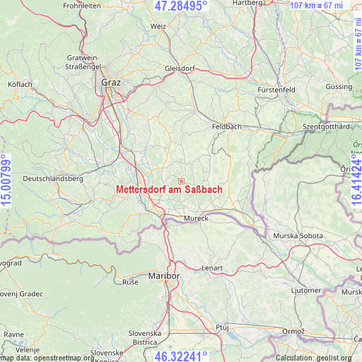
46° 48' 20.988" North, 15° 42' 39.996" East
| Map corner | latitude | longitude |
|---|---|---|
| Upper-left | 47.28495°, | 15.00799° |
| Center: | 46.80583°, | 15.71111° |
| Lower-right: | 46.32241°, | 16.41424° |
| Map W x H: | 107×107 km | = 66.5×66.5mi |
| max Lat: | 48.98333° ⇑91.8% North |
| Mettersdorf am Saßbach: | 46.80583° |
| min Lat: | ⇓8.2% South 46.48841° |
| min Long | Mettersdorf am | max Long |
| 9.57802° | 15.71111° | 17.1° |
| W 72.4%⇐ | ⇒27.6% E |
Elevation
Elevation of Mettersdorf am Saßbach is 279 m = 915 ft, and this is 226.5 m = 743 ft below average elevation for this country.
| Max E: |
2140 m = 7021 ft | 79% |
| Avg. | 505.5 m = 1658 ft | |
| Mettersdorf am Saßbach | 279 m = 915 ft | |
Min E: |
118 m = 387 ft | 21% |
See also: Austria elevation on elevation.city.
Geographical zone
Mettersdorf am Saßbach is located in North temperate zone (between Tropic of Cancer and the Arctic Circle). Distance of this North polar circle is 2196.9 km =1365.1 mi to North.| Distance of | km | miles | from Mettersdorf am Saßbach |
|---|---|---|---|
| North Pole | 4802.7 | 2984.3 | to North |
| Arctic Circle | 2196.9 | 1365.1 | to North |
| Tropic Cancer | 2598.4 | 1614.6 | to South |
| Equator | 5204.3 | 3233.8 | to South |


Nearby cities:
15 places around Mettersdorf am Saßbach: (largest is in red/bold)
• Bierbaum am Auersbach
6.7 km =4.2 mi,  66°
66°
• Breitenfeld am Tannenriegel
7.7 km =4.8 mi,  309°
309°
• Dietersdorf am Gnasbach
7.7 km =4.8 mi,  87°
87°
• Glojach
7.6 km =4.7 mi,  333°
333°
• Hainsdorf im Schwarzautal
6.3 km =3.9 mi,  302°
302°
• Jagerberg
5.7 km =3.5 mi,  21°
21°
• Raning
9.4 km =5.8 mi,  58°
58°
• Sankt Nikolai ob Draßling
4.6 km =2.9 mi,  274°
274°
• Sankt Peter am Ottersbach
3.8 km =2.4 mi,  103°
103°
• Sankt Veit am Vogau
9 km =5.6 mi,  215°
215°
• Schwarzau im Schwarzautal
8.9 km =5.5 mi,  336°
336°
• Trössing
8.1 km =5 mi,  81°
81°
• Unterauersbach
8 km =5 mi,  34°
34°
• Weinburg am Saßbach
5.9 km =3.7 mi,  172°
172°
• Wolfsberg im Schwarzautal
5.8 km =3.6 mi,  316°
316°
Sources, notices
• [Note1] Compared only with cities in Austria existing in our database
• [Src1] Map data: © OpenStreetMap contributors (CC-BY-SA)
• [Src2] Other city data from geonames.org with taken over terms of usage.
• [Src3] Geographical zone / Annual Mean Temperature by Robert A. Rohde @ Wikipedia
