Raning geodata
Raning (Styria) is a seat of a third-order administrative division; located in Austria in Europe/Vienna (GMT+2) time zone. With population of 510 people, there are 2471 cities with bigger population in this country. Compared to other cities in Austria, 89.7% of cities are located further ↑North; 75.1% of cities are located further ←West and 77.8% of cities have higher elevation than Raning. Note1
Administrative division(s):
- Level 1: Styria
- Level 2: Politischer Bezirk Südoststeiermark
- Level 3: Gnas


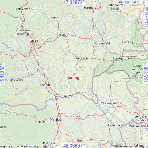
Raning GPS coordinates[2]
46° 51' 0" North, 15° 49' 0.012" East
| Map corner | latitude | longitude |
|---|---|---|
| Upper-left | 47.32872°, | 15.11355° |
| Center: | 46.85°, | 15.81667° |
| Lower-right: | 46.36697°, | 16.5198° |
| Map W x H: | 106.9×106.9 km | = 66.4×66.4mi |
| max Lat: | 48.98333° ⇑89.7% North |
| Raning: | 46.85° |
| min Lat: | ⇓10.3% South 46.48841° |
| min Long | Raning | max Long |
| 9.57802° | 15.81667° | 17.1° |
| W 75.1%⇐ | ⇒24.9% E |
Elevation
Elevation of Raning is 285 m = 935 ft, and this is 220.5 m = 723 ft below average elevation for this country.
| Max E: |
2140 m = 7021 ft | 77.8% |
| Avg. | 505.5 m = 1658 ft | |
| Raning | 285 m = 935 ft | |
Min E: |
118 m = 387 ft | 22.2% |
See also: Austria elevation on elevation.city.
Geographical zone
Raning is located in North temperate zone (between Tropic of Cancer and the Arctic Circle). Distance of this North polar circle is 2191.9 km =1362 mi to North.| Distance of | km | miles | from Raning |
|---|---|---|---|
| North Pole | 4797.8 | 2981.2 | to North |
| Arctic Circle | 2191.9 | 1362 | to North |
| Tropic Cancer | 2603.3 | 1617.6 | to South |
| Equator | 5209.2 | 3236.8 | to South |


Nearby cities:
15 places around Raning: (largest is in red/bold)
• Bierbaum am Auersbach
2.9 km =1.8 mi,  219°
219°
• Burgfried
3.5 km =2.2 mi,  21°
21°
• Dietersdorf am Gnasbach
4.6 km =2.9 mi,  184°
184°
• Gnas
2.6 km =1.6 mi,  14°
14°
• Grabersdorf
1 km =0.6 mi,  141°
141°
• Jagerberg
6 km =3.7 mi,  273°
273°
• Kohlberg
6.1 km =3.8 mi,  335°
335°
• Krusdorf
3.6 km =2.2 mi,  109°
109°
• Maierdorf
5.4 km =3.4 mi,  27°
27°
• Poppendorf
3.1 km =1.9 mi,  77°
77°
• Stainz bei Straden
6.4 km =4 mi,  116°
116°
• Straden
6 km =3.7 mi, 139°
• Trautmannsdorf in Oststeiermark
5.9 km =3.7 mi,  61°
61°
• Trössing
3.7 km =2.3 mi, 180°
• Unterauersbach
3.9 km =2.4 mi,  296°
296°
Sources, notices
• [Note1] Compared only with cities in Austria existing in our database
• [Src1] Map data: © OpenStreetMap contributors (CC-BY-SA)
• [Src2] Other city data from geonames.org with taken over terms of usage.
• [Src3] Geographical zone / Annual Mean Temperature by Robert A. Rohde @ Wikipedia
