Leobendorf geodata
Leobendorf (Lower Austria) is a seat of a third-order administrative division; located in Austria in Europe/Vienna (GMT+2) time zone. With population of 2,802 people, there are 412 cities with bigger population in this country. Compared to other cities in Austria, 89.8% of cities are located further ↓South; 89.2% of cities are located further ←West and 87.2% of cities have higher elevation than Leobendorf. Note1
Administrative division(s):
- Level 1: Lower Austria
- Level 2: Politischer Bezirk Korneuburg
- Level 3: Leobendorf


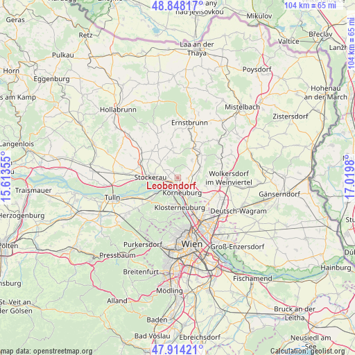
Leobendorf GPS coordinates[2]
48° 22' 59.988" North, 16° 19' 0.012" East
| Map corner | latitude | longitude |
|---|---|---|
| Upper-left | 48.84817°, | 15.61355° |
| Center: | 48.38333°, | 16.31667° |
| Lower-right: | 47.91421°, | 17.0198° |
| Map W x H: | 103.8×103.8 km | = 64.5×64.5mi |
| max Lat: | 48.98333° ⇑10.2% North |
| Leobendorf: | 48.38333° |
| min Lat: | ⇓89.8% South 46.48841° |
| min Long | Leobendorf | max Long |
| 9.57802° | 16.31667° | 17.1° |
| W 89.2%⇐ | ⇒10.8% E |
Elevation
Elevation of Leobendorf is 234 m = 768 ft, and this is 271.5 m = 891 ft below average elevation for this country.
| Max E: |
2140 m = 7021 ft | 87.2% |
| Avg. | 505.5 m = 1658 ft | |
| Leobendorf | 234 m = 768 ft | |
Min E: |
118 m = 387 ft | 12.8% |
See also: Austria elevation on elevation.city.
Geographical zone
Leobendorf is located in North temperate zone (between Tropic of Cancer and the Arctic Circle). Distance of this North polar circle is 2021.5 km =1256.1 mi to North.| Distance of | km | miles | from Leobendorf |
|---|---|---|---|
| North Pole | 4627.3 | 2875.3 | to North |
| Arctic Circle | 2021.5 | 1256.1 | to North |
| Tropic Cancer | 2773.8 | 1723.6 | to South |
| Equator | 5379.7 | 3342.8 | to South |


Nearby cities:
15 places around Leobendorf: (largest is in red/bold)
• Bisamberg
6.1 km =3.8 mi,  156°
156°
• Harmannsdorf
4.4 km =2.7 mi,  69°
69°
• Höflein an der Donau
4.9 km =3 mi,  219°
219°
• Klein-Engersdorf
7.4 km =4.6 mi,  138°
138°
• Korneuburg
3.9 km =2.4 mi, 161°
• Kritzendorf
6.1 km =3.8 mi,  191°
191°
• Leitzersdorf
6.6 km =4.1 mi,  307°
307°
• Niederhollabrunn
5.7 km =3.5 mi,  347°
347°
• Obergänserndorf
5.2 km =3.2 mi,  44°
44°
• Oberrohrbach
2.2 km =1.4 mi,  326°
326°
• Rückersdorf
4.1 km =2.5 mi,  75°
75°
• Spillern
4.9 km =3 mi,  270°
270°
• Stetten
5.3 km =3.3 mi,  110°
110°
• Stockerau
7.4 km =4.6 mi, 270°
• Tresdorf
2.5 km =1.6 mi,  90°
90°
Sources, notices
• [Note1] Compared only with cities in Austria existing in our database
• [Src1] Map data: © OpenStreetMap contributors (CC-BY-SA)
• [Src2] Other city data from geonames.org with taken over terms of usage.
• [Src3] Geographical zone / Annual Mean Temperature by Robert A. Rohde @ Wikipedia
