Leitzersdorf geodata
Leitzersdorf (Lower Austria) is a seat of a third-order administrative division; located in Austria in Europe/Vienna (GMT+2) time zone. With population of 648 people, there are 1992 cities with bigger population in this country. Compared to other cities in Austria, 91.5% of cities are located further ↓South; 87.2% of cities are located further ←West and 88.8% of cities have higher elevation than Leitzersdorf. Note1
Administrative division(s):
- Level 1: Lower Austria
- Level 2: Politischer Bezirk Korneuburg
- Level 3: Leitzersdorf


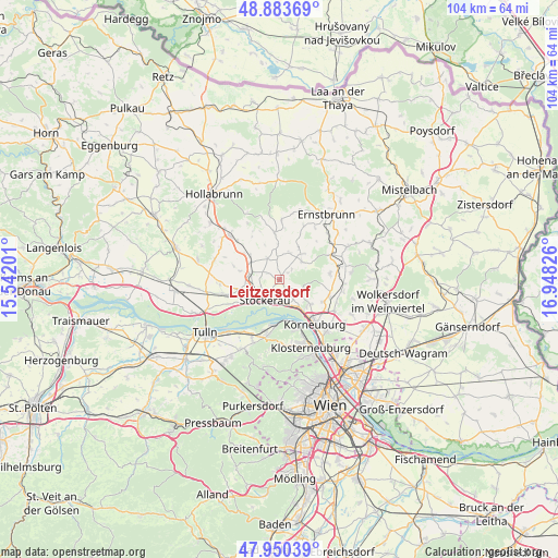
Leitzersdorf GPS coordinates[2]
48° 25' 9.048" North, 16° 14' 42.468" East
| Map corner | latitude | longitude |
|---|---|---|
| Upper-left | 48.88369°, | 15.54201° |
| Center: | 48.41918°, | 16.24513° |
| Lower-right: | 47.95039°, | 16.94826° |
| Map W x H: | 103.8×103.8 km | = 64.5×64.5mi |
| max Lat: | 48.98333° ⇑8.5% North |
| Leitzersdorf: | 48.41918° |
| min Lat: | ⇓91.5% South 46.48841° |
| min Long | Leitzersdorf | max Long |
| 9.57802° | 16.24513° | 17.1° |
| W 87.2%⇐ | ⇒12.8% E |
Elevation
Elevation of Leitzersdorf is 223 m = 732 ft, and this is 282.5 m = 927 ft below average elevation for this country.
| Max E: |
2140 m = 7021 ft | 88.8% |
| Avg. | 505.5 m = 1658 ft | |
| Leitzersdorf | 223 m = 732 ft | |
Min E: |
118 m = 387 ft | 11.2% |
See also: Austria elevation on elevation.city.
Geographical zone
Leitzersdorf is located in North temperate zone (between Tropic of Cancer and the Arctic Circle). Distance of this North polar circle is 2017.5 km =1253.6 mi to North.| Distance of | km | miles | from Leitzersdorf |
|---|---|---|---|
| North Pole | 4623.4 | 2872.8 | to North |
| Arctic Circle | 2017.5 | 1253.6 | to North |
| Tropic Cancer | 2777.8 | 1726 | to South |
| Equator | 5383.7 | 3345.3 | to South |


Nearby cities:
15 places around Leitzersdorf: (largest is in red/bold)
• Altenberg
9.1 km =5.7 mi,  186°
186°
• Großmugl
9 km =5.6 mi,  353°
353°
• Harmannsdorf
9.7 km =6 mi,  104°
104°
• Höflein an der Donau
8 km =5 mi,  164°
164°
• Korneuburg
10.1 km =6.3 mi,  139°
139°
• Leobendorf
6.6 km =4.1 mi,  127°
127°
• Niederhollabrunn
4.3 km =2.7 mi,  68°
68°
• Obergänserndorf
9 km =5.6 mi,  91°
91°
• Oberrohrbach
4.6 km =2.9 mi,  117°
117°
• Rückersdorf
9.7 km =6 mi,  107°
107°
• Sierndorf
5.9 km =3.7 mi,  281°
281°
• Spillern
4 km =2.5 mi,  174°
174°
• Stockerau
4.5 km =2.8 mi,  207°
207°
• Tresdorf
8.7 km =5.4 mi, 117°
• Wördern
9.8 km =6.1 mi,  195°
195°
Sources, notices
• [Note1] Compared only with cities in Austria existing in our database
• [Src1] Map data: © OpenStreetMap contributors (CC-BY-SA)
• [Src2] Other city data from geonames.org with taken over terms of usage.
• [Src3] Geographical zone / Annual Mean Temperature by Robert A. Rohde @ Wikipedia
