Stetten geodata
Stetten (Lower Austria) is a seat of a third-order administrative division; located in Austria in Europe/Vienna (GMT+2) time zone. With population of 1,357 people, there are 931 cities with bigger population in this country. Compared to other cities in Austria, 89.3% of cities are located further ↓South; 90.8% of cities are located further ←West and 94.7% of cities have higher elevation than Stetten. Note1
Administrative division(s):
- Level 1: Lower Austria
- Level 2: Politischer Bezirk Korneuburg
- Level 3: Stetten


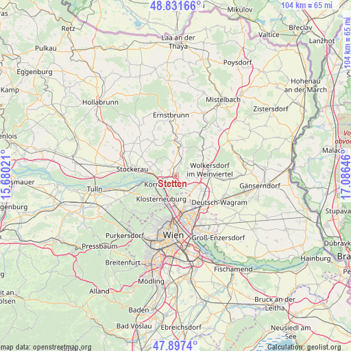
Stetten GPS coordinates[2]
48° 22' 0.012" North, 16° 22' 59.988" East
| Map corner | latitude | longitude |
|---|---|---|
| Upper-left | 48.83166°, | 15.68021° |
| Center: | 48.36667°, | 16.38333° |
| Lower-right: | 47.8974°, | 17.08646° |
| Map W x H: | 103.9×103.9 km | = 64.6×64.6mi |
| max Lat: | 48.98333° ⇑10.7% North |
| Stetten: | 48.36667° |
| min Lat: | ⇓89.3% South 46.48841° |
| min Long | Stetten | max Long |
| 9.57802° | 16.38333° | 17.1° |
| W 90.8%⇐ | ⇒9.2% E |
Elevation
Elevation of Stetten is 181 m = 594 ft, and this is 324.5 m = 1065 ft below average elevation for this country.
| Max E: |
2140 m = 7021 ft | 94.7% |
| Avg. | 505.5 m = 1658 ft | |
| Stetten | 181 m = 594 ft | |
Min E: |
118 m = 387 ft | 5.3% |
See also: Austria elevation on elevation.city.
Geographical zone
Stetten is located in North temperate zone (between Tropic of Cancer and the Arctic Circle). Distance of this North polar circle is 2023.3 km =1257.2 mi to North.| Distance of | km | miles | from Stetten |
|---|---|---|---|
| North Pole | 4629.2 | 2876.5 | to North |
| Arctic Circle | 2023.3 | 1257.2 | to North |
| Tropic Cancer | 2772 | 1722.4 | to South |
| Equator | 5377.9 | 3341.7 | to South |


Nearby cities:
15 places around Stetten: (largest is in red/bold)
• Bisamberg
4.5 km =2.8 mi,  213°
213°
• Enzersfeld
3 km =1.9 mi,  96°
96°
• Großebersdorf
6.5 km =4 mi,  92°
92°
• Hagenbrunn
3.9 km =2.4 mi,  161°
161°
• Harmannsdorf
3.5 km =2.2 mi,  346°
346°
• Klein-Engersdorf
3.7 km =2.3 mi,  180°
180°
• Korneuburg
4.1 km =2.5 mi,  243°
243°
• Königsbrunn im Weinviertel
2.8 km =1.7 mi,  137°
137°
• Langenzersdorf
7.1 km =4.4 mi,  193°
193°
• Leobendorf
5.3 km =3.3 mi,  290°
290°
• Münichsthal
6.4 km =4 mi,  73°
73°
• Obergänserndorf
5.7 km =3.5 mi, 347°
• Rückersdorf
3.1 km =1.9 mi,  341°
341°
• Tresdorf
3.1 km =1.9 mi,  306°
306°
• Würnitz
6.1 km =3.8 mi,  23°
23°
Sources, notices
• [Note1] Compared only with cities in Austria existing in our database
• [Src1] Map data: © OpenStreetMap contributors (CC-BY-SA)
• [Src2] Other city data from geonames.org with taken over terms of usage.
• [Src3] Geographical zone / Annual Mean Temperature by Robert A. Rohde @ Wikipedia
