Großmugl geodata
Großmugl (Lower Austria) is a seat of a third-order administrative division; located in Austria in Europe/Vienna (GMT+2) time zone. With population of 543 people, there are 2346 cities with bigger population in this country. Compared to other cities in Austria, 94.3% of cities are located further ↓South; 86.8% of cities are located further ←West and 89.5% of cities have higher elevation than Großmugl. Note1
Administrative division(s):
- Level 1: Lower Austria
- Level 2: Politischer Bezirk Korneuburg
- Level 3: Großmugl


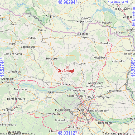
Großmugl GPS coordinates[2]
48° 29' 57.012" North, 16° 13' 50.016" East
| Map corner | latitude | longitude |
|---|---|---|
| Upper-left | 48.96294°, | 15.52744° |
| Center: | 48.49917°, | 16.23056° |
| Lower-right: | 48.03112°, | 16.93369° |
| Map W x H: | 103.6×103.6 km | = 64.4×64.4mi |
| max Lat: | 48.98333° ⇑5.7% North |
| Großmugl: | 48.49917° |
| min Lat: | ⇓94.3% South 46.48841° |
| min Long | Großmugl | max Long |
| 9.57802° | 16.23056° | 17.1° |
| W 86.8%⇐ | ⇒13.2% E |
Elevation
Elevation of Großmugl is 216 m = 709 ft, and this is 289.5 m = 950 ft below average elevation for this country.
| Max E: |
2140 m = 7021 ft | 89.5% |
| Avg. | 505.5 m = 1658 ft | |
| Großmugl | 216 m = 709 ft | |
Min E: |
118 m = 387 ft | 10.5% |
See also: Austria elevation on elevation.city.
Geographical zone
Großmugl is located in North temperate zone (between Tropic of Cancer and the Arctic Circle). Distance of this North polar circle is 2008.6 km =1248.1 mi to North.| Distance of | km | miles | from Großmugl |
|---|---|---|---|
| North Pole | 4614.5 | 2867.3 | to North |
| Arctic Circle | 2008.6 | 1248.1 | to North |
| Tropic Cancer | 2786.7 | 1731.6 | to South |
| Equator | 5392.6 | 3350.8 | to South |


Nearby cities:
15 places around Großmugl: (largest is in red/bold)
• Breitenwaida
12.1 km =7.5 mi,  270°
270°
• Ernstbrunn
9.6 km =6 mi,  66°
66°
• Großrußbach
14 km =8.7 mi,  101°
101°
• Göllersdorf
8.2 km =5.1 mi, 265°
• Hollabrunn
12.2 km =7.6 mi,  297°
297°
• Leitzersdorf
9 km =5.6 mi,  173°
173°
• Leobendorf
14.4 km =8.9 mi,  153°
153°
• Niederhollabrunn
8.9 km =5.5 mi, 145°
• Niederleis
13.7 km =8.5 mi, 65°
• Obergänserndorf
13.6 km =8.5 mi,  132°
132°
• Oberrohrbach
12.2 km =7.6 mi,  155°
155°
• Sierndorf
9 km =5.6 mi,  211°
211°
• Sonnberg
13.8 km =8.6 mi,  285°
285°
• Spillern
13 km =8.1 mi, 173°
• Stockerau
12.9 km =8 mi,  184°
184°
Sources, notices
• [Note1] Compared only with cities in Austria existing in our database
• [Src1] Map data: © OpenStreetMap contributors (CC-BY-SA)
• [Src2] Other city data from geonames.org with taken over terms of usage.
• [Src3] Geographical zone / Annual Mean Temperature by Robert A. Rohde @ Wikipedia
