Langenzersdorf geodata
Langenzersdorf (Lower Austria) is a seat of a third-order administrative division; located in Austria in Europe/Vienna (GMT+2) time zone. With population of 8,137 people, there are 112 cities with bigger population in this country. Compared to other cities in Austria, 86% of cities are located further ↓South; 90.1% of cities are located further ←West and 97.2% of cities have higher elevation than Langenzersdorf. Note1
Administrative division(s):
- Level 1: Lower Austria
- Level 2: Politischer Bezirk Korneuburg
- Level 3: Langenzersdorf


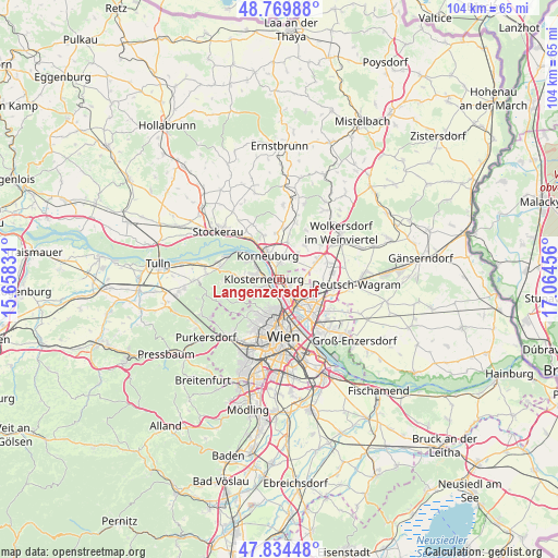
Langenzersdorf GPS coordinates[2]
48° 18' 15.552" North, 16° 21' 41.148" East
| Map corner | latitude | longitude |
|---|---|---|
| Upper-left | 48.76988°, | 15.65831° |
| Center: | 48.30432°, | 16.36143° |
| Lower-right: | 47.83448°, | 17.06456° |
| Map W x H: | 104×104 km | = 64.6×64.6mi |
| max Lat: | 48.98333° ⇑14% North |
| Langenzersdorf: | 48.30432° |
| min Lat: | ⇓86% South 46.48841° |
| min Long | Langenzersdorf | max Long |
| 9.57802° | 16.36143° | 17.1° |
| W 90.1%⇐ | ⇒9.9% E |
Elevation
Elevation of Langenzersdorf is 161 m = 528 ft, and this is 344.5 m = 1130 ft below average elevation for this country.
| Max E: |
2140 m = 7021 ft | 97.2% |
| Avg. | 505.5 m = 1658 ft | |
| Langenzersdorf | 161 m = 528 ft | |
Min E: |
118 m = 387 ft | 2.8% |
See also: Austria elevation on elevation.city.
Geographical zone
Langenzersdorf is located in North temperate zone (between Tropic of Cancer and the Arctic Circle). Distance of this North polar circle is 2030.2 km =1261.5 mi to North.| Distance of | km | miles | from Langenzersdorf |
|---|---|---|---|
| North Pole | 4636.1 | 2880.7 | to North |
| Arctic Circle | 2030.2 | 1261.5 | to North |
| Tropic Cancer | 2765 | 1718.1 | to South |
| Equator | 5370.9 | 3337.3 | to South |


Nearby cities:
15 places around Langenzersdorf: (largest is in red/bold)
• Bisamberg
3.3 km =2.1 mi,  345°
345°
• Enzersfeld
8 km =5 mi,  35°
35°
• Floridsdorf
6.7 km =4.2 mi,  154°
154°
• Gerasdorf bei Wien
7.9 km =4.9 mi,  97°
97°
• Gugging
8.4 km =5.2 mi,  277°
277°
• Hagenbrunn
4.3 km =2.7 mi, 41°
• Höflein an der Donau
8.2 km =5.1 mi,  308°
308°
• Kierling
6.3 km =3.9 mi, 275°
• Klein-Engersdorf
3.6 km =2.2 mi,  26°
26°
• Klosterneuburg
2.7 km =1.7 mi,  272°
272°
• Korneuburg
5.5 km =3.4 mi,  337°
337°
• Kritzendorf
5.3 km =3.3 mi,  301°
301°
• Königsbrunn im Weinviertel
6 km =3.7 mi, 36°
• Stetten
7.1 km =4.4 mi,  13°
13°
• Weidling
4.2 km =2.6 mi,  249°
249°
Sources, notices
• [Note1] Compared only with cities in Austria existing in our database
• [Src1] Map data: © OpenStreetMap contributors (CC-BY-SA)
• [Src2] Other city data from geonames.org with taken over terms of usage.
• [Src3] Geographical zone / Annual Mean Temperature by Robert A. Rohde @ Wikipedia
