Hagenbrunn geodata
Hagenbrunn (Lower Austria) is a seat of a third-order administrative division; located in Austria in Europe/Vienna (GMT+2) time zone. With population of 1,875 people, there are 664 cities with bigger population in this country. Compared to other cities in Austria, 87.5% of cities are located further ↓South; 91.2% of cities are located further ←West and 88% of cities have higher elevation than Hagenbrunn. Note1
Administrative division(s):
- Level 1: Lower Austria
- Level 2: Politischer Bezirk Korneuburg
- Level 3: Hagenbrunn


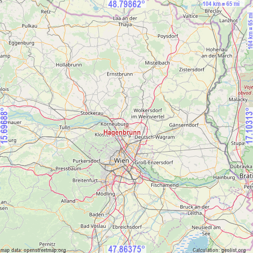
Hagenbrunn GPS coordinates[2]
48° 19' 59.988" North, 16° 24' 0" East
| Map corner | latitude | longitude |
|---|---|---|
| Upper-left | 48.79862°, | 15.69688° |
| Center: | 48.33333°, | 16.4° |
| Lower-right: | 47.86375°, | 17.10313° |
| Map W x H: | 103.9×103.9 km | = 64.6×64.6mi |
| max Lat: | 48.98333° ⇑12.5% North |
| Hagenbrunn: | 48.33333° |
| min Lat: | ⇓87.5% South 46.48841° |
| min Long | Hagenbrunn | max Long |
| 9.57802° | 16.4° | 17.1° |
| W 91.2%⇐ | ⇒8.8% E |
Elevation
Elevation of Hagenbrunn is 229 m = 751 ft, and this is 276.5 m = 907 ft below average elevation for this country.
| Max E: |
2140 m = 7021 ft | 88% |
| Avg. | 505.5 m = 1658 ft | |
| Hagenbrunn | 229 m = 751 ft | |
Min E: |
118 m = 387 ft | 12% |
See also: Austria elevation on elevation.city.
Geographical zone
Hagenbrunn is located in North temperate zone (between Tropic of Cancer and the Arctic Circle). Distance of this North polar circle is 2027 km =1259.5 mi to North.| Distance of | km | miles | from Hagenbrunn |
|---|---|---|---|
| North Pole | 4632.9 | 2878.7 | to North |
| Arctic Circle | 2027 | 1259.5 | to North |
| Tropic Cancer | 2768.2 | 1720.1 | to South |
| Equator | 5374.2 | 3339.4 | to South |


Nearby cities:
15 places around Hagenbrunn: (largest is in red/bold)
• Bisamberg
3.7 km =2.3 mi,  270°
270°
• Enzersfeld
3.8 km =2.4 mi,  27°
27°
• Gerasdorf bei Wien
6.6 km =4.1 mi,  130°
130°
• Großebersdorf
6.2 km =3.9 mi,  56°
56°
• Klein-Engersdorf
1.3 km =0.8 mi, 268°
• Klosterneuburg
6.4 km =4 mi,  240°
240°
• Korneuburg
5.3 km =3.3 mi,  290°
290°
• Kritzendorf
7.4 km =4.6 mi, 266°
• Königsbrunn im Weinviertel
1.8 km =1.1 mi,  22°
22°
• Langenzersdorf
4.3 km =2.7 mi,  221°
221°
• Münichsthal
7.4 km =4.6 mi,  41°
41°
• Rückersdorf
7 km =4.3 mi,  341°
341°
• Seyring
6.2 km =3.9 mi,  90°
90°
• Stetten
3.9 km =2.4 mi, 341°
• Tresdorf
6.7 km =4.2 mi,  326°
326°
Sources, notices
• [Note1] Compared only with cities in Austria existing in our database
• [Src1] Map data: © OpenStreetMap contributors (CC-BY-SA)
• [Src2] Other city data from geonames.org with taken over terms of usage.
• [Src3] Geographical zone / Annual Mean Temperature by Robert A. Rohde @ Wikipedia
